PDF-SLOSH Based Inundation MapsWhat is SLOSH?SLOSH stands for Sea, Lake, a
Author : trish-goza | Published Date : 2015-09-04
The SLOSH Display ProgramThe National Weather Service has run several thousand hypothetical hurricanes for each basin with the SLOSH modelhe resulting flooding data
Presentation Embed Code
Download Presentation
Download Presentation The PPT/PDF document "SLOSH Based Inundation MapsWhat is SLOSH..." is the property of its rightful owner. Permission is granted to download and print the materials on this website for personal, non-commercial use only, and to display it on your personal computer provided you do not modify the materials and that you retain all copyright notices contained in the materials. By downloading content from our website, you accept the terms of this agreement.
SLOSH Based Inundation MapsWhat is SLOSH?SLOSH stands for Sea, Lake, a: Transcript
The SLOSH Display ProgramThe National Weather Service has run several thousand hypothetical hurricanes for each basin with the SLOSH modelhe resulting flooding data from each run are savedIn the New. Realty Executives Lake Havasu City will help you find a home in Lake Havasu City. Contact us Today.
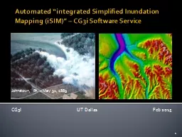
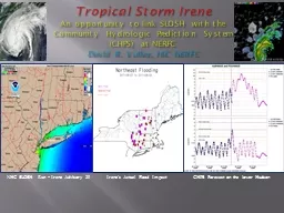
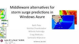
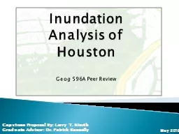
iSIM. )” – CG3i Software Service. CG3I UT Dallas Feb 2015. 1. Johnstown, PA – May 31, 1889. Beth . Plale. (PI), Indiana University | Craig Mattocks (Co-PI), University of Miami. . Figure: . Scheduling tasks in Azure using . Sigiri. Middleware. Climate change can have adverse impacts on strength of storms. Even modest changes in Ocean surface temperature can have a significant impact on hurricane strength, making the coastal regions increasingly vulnerable to storm surge. . Somerset County, Maryland. URS Group . Inc. 2010 ASFPM National Conference. May 2010. Current Shoreline 2008. Sea Level Rise 2025. Sea Level Rise 2050. Sea Level Rise 2100. Inundation Area. Inundation – Deal Island, MD . CHPS Forecast on the lower Hudson. Irene’s Actual Flood Impact. Tropical Storm Irene. An opportunity. to link SLOSH with the Community Hydrologic Prediction System (CHPS) at NERFC . David R. Vallee, HIC NERFC. Beth Plale. Kavitha. . Chandrasekar. Milinda. . Pathridge. Craig Mattocks . Samindra. . Wijeratne. The Storm Surge. An immediate and dangerous impact of climate change is change in strength of storms that form over oceans making coastal communities increasingly vulnerable to storm surge. . : . Mapping American Archival Vulnerabilities to Climate Change. Researchers. Eira Tansey. Digital Archivist,. Records Manager. University of Cincinnati. Ben Goldman. Digital Records Archivist,. Kalin Librarian for Technological Innovations. Doug Marcy. NOAA Coastal Services Center. ASFPM 2011. May . 17. State, Regional, and County Needs. Assistance with collection of consistent, standardized elevation data and avoidance of duplication. Federal agency guidance and justification for flood, tide, and storm elevations for coastal areas to use for creating inundation models. Geog 596A Peer Review. Capstone Proposal By. : Larry . T. Nierth. Graduate Advisor: Dr. Patrick Kennelly. May 2013. Background Information . Goals and Objectives. Methodology. Anticipated Project Results . CPR Lake Forest CA
https://yourcprmd.com/orangecounty/
Palm Desert Resuscitation Education (PDRE) is among Southern California’s best and frontrunner in American Heart Association (AHA), American Academy of Pediatrics (AAP), American Red Cross (ARC) and other classroom-based and online education, up-to-date news and information delivery.
We want to advance our mission of promoting healthier lives and assist in reducing the morbidity and mortality of cardiovascular diseases, stroke, and other medical emergencies through evidenced-based learning and professional education as per the most current AHA, AAP, ARC, and other guidelines and recommendations.
CPR Lake Forest CA, CPR Classes Lake Forest CA, CPR Certification Lake Forest CA, First Aid Certification Lake Forest CA, BLS Lake Forest CA 1
Connecticut Environmental Conditions Online
–
www.cteco.uconn.edu
Hurricane Surge Inundation
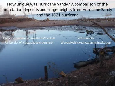
DescriptionThis information includes HurricaneSurge Inundation areas for category 1 through 4 hurri We all want an adaptable, affordable, efficient marketing solution that can handle all of these things, right? Well, banner stands are here to save the day! They\'re like the superheroes of the marketing world, ready to swing in and elevate your brand.Visit us: https://www.bannerstandpros.com/ for more details. A comparison of the inundation deposits and surge heights from Hurricane Sandy and the 1821 . hurricane. Christine Brandon & Jonathan Woodruff. University of Massachusetts Amherst. Jeff Donnelly. What does this quick guide cover?. How to get started. 1. Renting or purchasing your stand. Key questions to ask your contractor. About Better Stands. What’s in it for me?. What do I need to do?. What are the guidelines?.
Download Document
Here is the link to download the presentation.
"SLOSH Based Inundation MapsWhat is SLOSH?SLOSH stands for Sea, Lake, a"The content belongs to its owner. You may download and print it for personal use, without modification, and keep all copyright notices. By downloading, you agree to these terms.
Related Documents