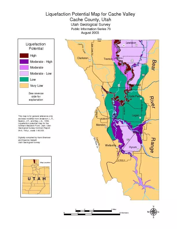
PDF-Liquefaction Potential Map for Cache ValleyCache County, UtahUtah Geol
89
91
142
N 1600 EN 7200 WStink Creek RdN 3200 W
23
Smithfield
Hyde Park
Logan
Millville
Hyrum
Wellsville
Mendon
Trenton
Clarkston
61
LewistonBear RiverBox Elder
Download Presentation
"Liquefaction Potential Map for Cache ValleyCache County, Uta " is the property of its rightful owner. Permission is granted to download and print materials on this website for personal, non-commercial use only, provided you retain all copyright notices. By downloading content from our website, you accept the terms of this agreement.
Presentation Transcript
Transcript not available.