Explore
Featured
Recent
Articles
Topics
Login
Upload
Featured
Recent
Articles
Topics
Login
Upload
Search Results for 'Visualizing-Geospatial'
Visualizing-Geospatial published presentations and documents on DocSlides.
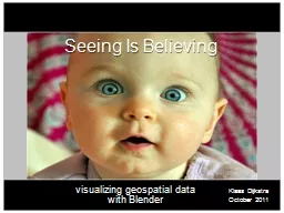
Seeing
by lois-ondreau
Is . Believing. visualizing. . geospatial. dat...
Visualizing: So Simple, Yet Complex
by luanne-stotts
4 Steps to Visualizing. Read the text. . Picture ...
Visualizing Expressive Performance in Tempo-Loudness Space
by min-jolicoeur
Presented by . Vinoth. . Kulaveerasingam. QMUL E...
Geospatial Platform Update
by isaac463
NGAC Meeting. December 7, 2010. Karen Siderelis. G...
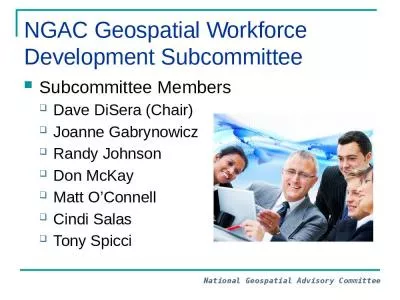
NGAC Geospatial Workforce Development Subcommittee
by osiris
Subcommittee Members. Dave DiSera (Chair). Joanne ...
NGAC Geospatial Partnerships with Tribes
by westley354
Chair: . David Wyatt. Members:. . J. Johnston, ...
GDRS and you! Geospatial Data Resource Sites
by leah
Tim Loesch, MN DNR. Presentation to the . Statewid...
Geospatial Analysis and Modeling - NCSU MEAS – Helena Mitasova
by ivy
Geomorphometry I: . Terrain modeling. Geospatial A...
EVOLUTION OF THE BCC GEOSPATIAL CENTER OF THE
by angelina
CUNY CREST INSTITUTE (2010-). Growth of the BCC Ge...
The US geospatial intelligence effort began in 1803 when President Tho
by callie
On 21 June 1956 President Eisenhower ordered the c...
Welcome to the VCCS Geospatial Institute
by scoopulachanel
With support from:. NSF DUE-0903270. Hosted by the...
September 23, 2015 Statewide Geospatial Advisory Council
by briana-ranney
Call to order and . introductions. Approval . of ...
Integrating Official Statistics and Geospatial Information
by danika-pritchard
– ABS experience . Frank Yu. First Assistant St...
Copyright © 2017 Open Geospatial Consortium
by luanne-stotts
. Copyright © 2017 Open Geospatial Consortium. ...
Geospatial Data Abstraction Library (GDAL) Enhancement for
by giovanna-bartolotta
). Increasing . Accessibility and Interoperabilit...
Free and Open Source Geospatial Software and Data
by tawny-fly
Ioannis. . Kokkinidis. Geospatial and Environmen...
The X3D Geospatial Component: X3DOM implementation of
by alexa-scheidler
GeoOrigin. , . GeoLocation. , . GeoViewpoint. , a...
The History of Social Security
by linda
ESSENTIAL DILEMMA. Social Security Act of 1935: . ...
70-778 : Analyzing and Visualizing Data with Microsoft Power BI
by Intrilogy
kindly visit us at www.examsdump.com. Prepare your...
70-779 : Analyzing and Visualizing Data with Microsoft Excel
by Intrilogy
kindly visit us at www.examsdump.com. Prepare your...
70-778 : Analyzing and Visualizing Data with Microsoft Power BI
by Empire
kindly visit us at www.nexancourse.com. Prepare yo...
70-779 : Analyzing and Visualizing Data with Microsoft Excel
by Empire
kindly visit us at www.nexancourse.com. Prepare yo...
Chapter 1 Visualizing Technology
by jane-oiler
Copyright © 2014 Pearson Education, Inc. Publish...
Visualizing Documents and Search
by debby-jeon
Agenda. Introduction. Visual Principles . What Wo...
Generative Adversarial Nets
by lois-ondreau
ML Reading . Group. Xiao Lin. Jul. 22 2015. I. . ...
Chapter 4 Hardware Visualizing Technology
by pamella-moone
Copyright © 2014 Pearson Education, Inc. Publish...
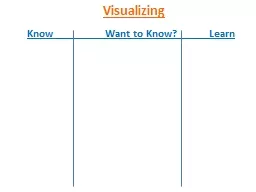
Know Want to Know? Learn
by phoebe-click
Visualizing. 3 Different Types of Visualizing:. S...
By N. Marlo Ballard, M.S.T.
by lois-ondreau
Instructions. : Run the presentation in “. Slid...
INFM 603: Information Technology and Organizational Context
by liane-varnes
Jimmy Lin. The . iSchool. University of Maryland....
By N.
by sherrill-nordquist
Marlo. Ballard, M.S.T.. Instructions. : Run the ...
Phineas
by tawny-fly
L. . MacGuire. Gets Slimed . Chapter. 13-15 . ...
Reading Strategy: Visualize
by luanne-stotts
“If I can’t picture it, I can’t understand...
Visualizing
by karlyn-bohler
Service Demand. 2014 AzTA/ADOT Annual Conference ...
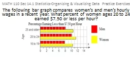
MATH 110 Sec 14.1 Statistics-Organizing & Visualizing D
by briana-ranney
The following bar graph compares women’s and me...
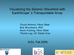
Visualizing the Seismic Wavefield with EarthScope
by pasty-toler
’. s Transportable Array. AGU, Fall 2008. Chuck...
What is a GIS? Geospatial technologies are technolo-gies for collecting and dealing with geographic
by tawny-fly
three main types: . . Global Positioning Systems...
Statewide Geospatial Advisory council November 28,
by tatyana-admore
Statewide Geospatial Advisory council November 28,...
The Cloud Services Innovation Platform:
by jaxon
Platform:. Enabling Service Based Environmental . ...
Geospatial Portfolio Management, Theme Lead and Dataset Manger Roles and Responsibilities, and the Investment Collaboration Process
by rudy
Theme Lead and Dataset Manger Roles and Responsibi...
Midyear Meeting National States Geographic Information Council
by elise
Review of NSGIC Midyear Meeting. Feb 27 – Mar 2,...
Load More...