Explore
Featured
Recent
Articles
Topics
Login
Upload
Featured
Recent
Articles
Topics
Login
Upload
Search Results for 'Topographic-Survey'
Topographic-Survey published presentations and documents on DocSlides.
Introduction to Cut Slope Design & Topographic Surveying
by felicity
Yonathan Admassu, PhD. James Madison . University....
Reading Contour Maps (Including Topographic Maps):
by badra
Visualizing 3D Surfaces. Carol J. Ormand. , . SERC...
Topographic Maps TEKS 8.9 C
by natalia-silvester
interpret topographic maps and satellite views to...
Topographic Maps
by luanne-stotts
Aim: To be able to interpret a topographic Map.....
Topographic Map Skills
by jane-oiler
Topographic notes. Topographic Map-includes conto...
Topographic
by marina-yarberry
Maps. Topographic Map. :. A . contour map. -. Co...
topographic Map
by tatyana-admore
exit ticket. Topographic Map Exit Ticket. 1) What...
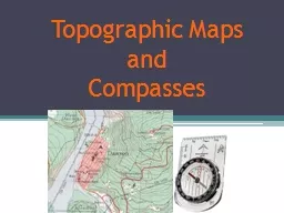
Topographic Maps
by briana-ranney
and . Compasses. Navigation Tools. Maps. Road map...
A Comparison of topographic effect by Newton’s integral a
by debby-jeon
YM . Wang, . S. . Holmes, J Saleh, XP Li . and D ...
Survey Services Company
by surveyservices
http://www.surveyservicescompany.com | SURVEY SERV...
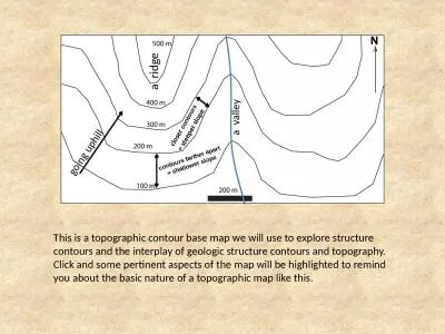
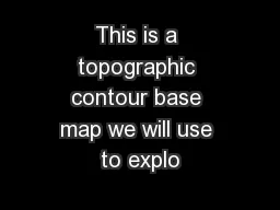
This is a topographic contour base map we will use to explore structure contours and the interplay
by natalie
a ridge. a valley. g. oing uphill. closer . cont...
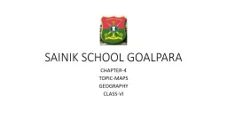
SAINIK SCHOOL GOALPARA CHAPTER-4
by morgan
TOPIC-MAPS. GEOGRAPHY. CLASS-VI. WHAT ARE MAPS?. A...
Land Navigation Identify Topographic Symbols
by luanne-stotts
on a Military Map. Action: . Identify Topographi...
Architectural Design
by jane-oiler
Mapping Mechanics: . An introduction to topograp...
The study of the shapes and features of the Earth’s su
by alexa-scheidler
Topography. Shows the three dimensional shape ...
Effect of topographical resolution
by cheryl-pisano
on . cirrus clouds . using . a high-resolution . ...
Drawing Cross Sections of a Topographical Map
by kittie-lecroy
Specific Skill. What you need. Ruler. Pencil. Gri...
Topographic Mapping
by kittie-lecroy
Goals. Define and describe topographic maps.. Def...
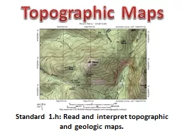
Standard 1.h: Read and interpret topographic and geologic m
by briana-ranney
Topographic Maps. Contouring. Topographic contour...
This is a topographic contour base map we will use to explo
by debby-jeon
a ridge. a valley. g. oing uphill. closer . con...
Hydro Treatments of
by alida-meadow
Lidar-Derived DEMs. Stereo DTM. (Topographic Surf...
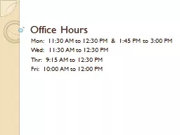
Office Hours
by tatyana-admore
Mon: 11:30 AM to 12:30 PM & 1:45 PM to 3:0...
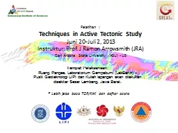
Pelatihan :
by stefany-barnette
Techniques in Active Tectonic Study. Juni 20-Juli...
Topographic Survey S pecification for Urban Projects
by faustina-dinatale
Presented by . Shane MacLaughlin, Atlas Computers...
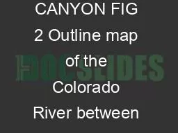
GRAND CANYON FIG 2 Outline map of the Colorado River between Lees Ferr
by yvonne
Birdseye joined the Geological Survey and began as...
Qatar’s Nation-Wide GIS
by natalia-silvester
Cooperation on Local and Regional Levels. Dr. Moh...
Assessment of the Use of Panel Survey Data by NCHS Population Health Survey Planning, Methodology and Data Presentation (PHSPMDP) BSC Workgroup
by lawrence
Population Health Survey Planning, Methodology and...
Legal Surveys Division Historical ReviewLegal Surveys Division Histo
by hadly
Division des lev
ESENER: The European Survey of Enterprises on New and Emerging Risks Session: How to survey health and safety at work in the changing world of work? Theory, challenges and practice-1 ESRA Conference, Zagreb, 18 July 2019
by telempsyc
Emerging Risks. Session: . ‘. How to survey hea...
Improving Survey Response Rates: The Effect of Embedded Questions in Web Survey Email Invitations
by doggcandy
Nick . Inchausti. , SurveyMonkey. Mingnan. Liu, F...
1 2017 Student Perception Survey: Survey
by ellena-manuel
Coordinator Training. Office of Policy and Evalu...
1 2017 Student Perception Survey: Survey
by olivia-moreira
Coordinator Training. Office of Policy and Evalu...
1 2016 Student Perception Survey: Survey
by yoshiko-marsland
Coordinator Training. Office . of . Policy and E...
1 2016 Student Perception Survey: Survey
by ellena-manuel
Coordinator Training. Office . of . Policy and E...
Executive Summary on National Survey on Milk Adulteration The National Survey on Milk Adulteration snap shot survey was conducted by the Food Safety and Standards Authority of India to ascertain the
by lois-ondreau
The survey was carried out by the Regional Office...
Year 3 Geography Monday 1
by brooke
st. March. L.O. . Name and locate areas of high g...
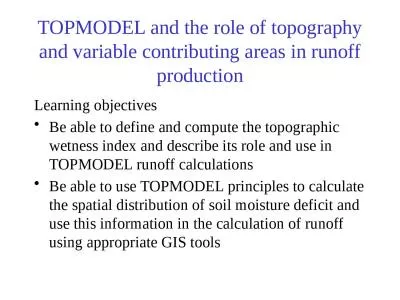
TOPMODEL and the role of topography and variable contributing areas in runoff production
by susan2
Learning objectives. Be able to define and compute...
Types of maps Types of maps
by eddey
How to read a map. Maps . are pictures of the Eart...
02 Route Location Reference
by brianna
:. J.G. . Schoon. , GEOMETRIC DESIGN PROJECTS FOR ...
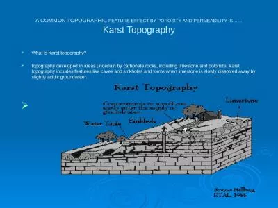
A COMMON TOPOGRAPHIC FEATURE EFFECT BY POROSITY AND
by molly
PERMEABILITY IS. ……. Karst Topography. What is...
Load More...