Explore
Featured
Recent
Articles
Topics
Login
Upload
Featured
Recent
Articles
Topics
Login
Upload
Search Results for 'Shapefile'
Shapefile published presentations and documents on DocSlides.
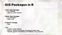
Intro to Spatial Analysis with
by luanne-stotts
What can we do with GIS?. SPATIAL STATISTICS. Wha...
Experiences of a Earth Science Data User
by tatiana-dople
Confessions of a Data Hoarder. Rob Carver, The We...
GIS Training Practising QGIS
by berey
Using the geomorphology and . GeoNames. toponyms ...
Remote Sensing and GIS Application
by rayfantasy
Lecturer. Ruba. . Yousif. . Hussain. Third Year....
More Ways to Make Your Friends Jealous Through Publishing Your
by mitsue-stanley
Geotagged. Photos. Got . Pics. ? . Nancy Milholl...
Children’s Medicaid Accessibility with GIS in South King County
by olivia-moreira
Youth Medicaid Alliance. In Partnership with Nort...
Prepared by: Jennifer McKee
by luanne-stotts
With support from:. in partnership with:. Introdu...
A View From Afar: The Use of Remote Sensing
by jane-oiler
Technologies to Examine Hopewell . Sites in Ohio ...
Using Stata to Create Interactive Maps
by conchita-marotz
Ali Lauer and . Austin Nichols. July 27, 2017. St...
Creating Stand Maps, Generating Plot Maps, and Upload/Download Plot Points to GPS
by min-jolicoeur
Create Stand Map with Topo Base Map. Open . ArcMa...
EEA/ENV seminar 1.June 13
by celsa-spraggs
Beate Werner. WISE and the future of WFD reportin...
Extensible and Usable Testing
by conchita-marotz
for Geographic Information System Automation. . ...
Poverty Accessibility to Resources & Services
by lindy-dunigan
Around the World. A GIS Analysis by:. Piecora. , ...
Athenians Project TEAM Clark Yin, Eunkyung Park, Aaron Boda,
by aaron
Dr. Meng Chen, Prof. Xiaohui Yu, . Prof. Jian-Guo...
Lesson 3 GIS Fundamentals
by lois-ondreau
MEASURE Evaluation. PHFI Training of Trainers. Ma...
Delaware Source Water Protection Polygons
by faustina-dinatale
Douglas Rambo, P.G.. Delaware Department of Natur...
Unit 9
by olivia-moreira
Infrared Product Generation. . Objectives. Discu...
Countywide Property Topography Shapefiles Contents Whats on the CDs Whats NOT on the CDs How do I order How much does it cost What file formats are available for the data How do I view the GIS data
by ellena-manuel
When purchasing the data in Shapefile format the ...
KATHLEEN SMALUK-NIX (ksmaluknix0001@kctcs.edu)
by stefany-barnette
GIS . STUDENT. WITH . THE GUIDANCE OF. PROFESSOR ...
Delaware Source Water Protection Polygons
by pamella-moone
Douglas Rambo, P.G.. Delaware Department of Natur...
Unit 9
by lindy-dunigan
Infrared Product Generation. . Objectives. Discu...
Load More...