Explore
Featured
Recent
Articles
Topics
Login
Upload
Featured
Recent
Articles
Topics
Login
Upload
Search Results for 'spatial information'
spatial information published presentations and documents on DocSlides.
A CyberGIS Environment for Near-Real-Time Spatial
by shangmaxi
Analysis. . of . Social Media Data . Shaowen Wang...
Importance of Developing Spatial Skills for Success in CS
by broadcastworld
Laura Reasoner Jones. Well-developed spatial ski...
Geog 301: Lecture 4 The value of spatial data
by elina
Again, portions swiped from Dr. Sterling Quinn. Wh...
Optimizing Channel Selection
by inventco
for Seizure Detection. V. Shah, . M. Golmohammadi,...
Value of I nformation Analysis in Spatial Models
by phoebe-click
Jo Eidsvik. Jo.eidsvik@ntnu.no. My . background. ...
TurfCast
by liane-varnes
: A Service for Controlling Information Dissemina...
From GPS and Google Maps
by min-jolicoeur
to Spatial Computing. June, 2016. Shashi. . Shek...
TurfCast
by jane-oiler
: A Service for Controlling Information Dissemina...
Spatial Data Management -The
by briana-ranney
St.Vincent. and the Grenadines Chapter. Author: ...
Lesson
by tawny-fly
5 Confidentiality. MEASURE Evaluation. PHFI Train...
Mapping the Spatial Diffusion of Innovations in Cyberspace
by ellena-manuel
Ming-Hsiang (Ming) Tsou . mtsou@mail.sdsu.edu...
AHA 2014, Getting
by lindy-dunigan
Started in Digital . History. Spatial History &am...
AHA 2014, Getting
by tatiana-dople
Started in Digital . History. Spatial History &am...
“ SERVING SOCIETY WITH GEOINFORMATICS
by sherrill-nordquist
”. ISPRS. 2013-SSG. Organized by:. ISPRS COMMIS...
Persian Verbs in Spatial Events
by debby-jeon
Catherine Nouri. North American conference in Ira...
Spatial Thinking and the GIS User Interface
by natalia-silvester
Michael F. Goodchild. University of California. S...
What is a GIS? Geospatial technologies are technolo-gies for collecting and dealing with geographic
by tawny-fly
three main types: . . Global Positioning Systems...
State of CyberGIS Shaowen Wang
by dailyno
CyberInfrastructure and Geospatial Information Lab...
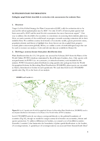
x0000x00001 xMCIxD 0 xMCIxD 0 SUPPLEMENTARY INFORMATION
by reese
Gallagher et alGlobal shortfalls in extinction ris...
TUZ GL NEW ABSOLUTE RADIOMETRIC CALIBRATION TEST SITE S Gurol H Ozen U
by jainy
Corresponding author Calibration is an important ...
Unit 2 Data Processing & Management
by nicole
TYIT SEM VI. D. ata processing system. Refers . to...
Maps and GIS Historical Maps
by melanie
The oldest map?. Konya . town map, Turkey, c. 6200...
GeoInformatic TupuPh D The Research Center of Geographic Information
by carny
Tel 86-731-8872982 Prof Institute of Geography CAS...
Analyzing Railroad Accidents Using Geographic Information S
by min-jolicoeur
Subhay. . manandhar. Geographic Information Syst...
Neogeography
by test
: the . challenge. of . channelling. . large. ...
Memory and Working Memory
by pamella-moone
An introduction. What have you forgotten?. 40. Wh...
University of North Alabama
by giovanna-bartolotta
Department of Geography. GeoINT. Workshop 2013. ...
Visualisation tools for noise and quiet.
by conchita-marotz
lithuania. Valdas Uscila. Ministry. . of. . Hea...
Victorian Curriculum
by trish-goza
Unpacking 7-10 Geography. Objectives. This sessio...
LIMBO @ SISSA
by tawny-fly
The Dentate Gyrus. a spatial. random. number. Gen...
Integrating Official Statistics and Geospatial Information
by danika-pritchard
– ABS experience . Frank Yu. First Assistant St...
Prof. Naimish R. Vadodariya
by natalia-silvester
naimish.vadodariya@darshan.ac.in. 91-8866215253....
Geographic Information Systems in Gerontology Research
by pasty-toler
Deborah Dunn, MPH. DrPH. Student . College Of Pu...
Geographic Information
by pasty-toler
Systems. ASM 215. Feb 2013. Larry Theller. Schedu...
x0000x0000 enGBxLanxg 00xLanxg 003D DOCUMENTATION AND DATA MANAGEME
by jones
The International Archives of the Photogrammetry R...
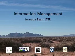
Information Management Jornada Basin LTER
by SunshineFlower
Jornada Information . management system. Six major...
Cartography I
by lindy-dunigan
LECTURE 1. Cartography I. History of Cartography....
Winter 2011 GIS Institute
by tawny-fly
Space:. Questions & Tools. First Off: Introdu...
GEOG 2681:
by alexa-scheidler
Cartography. Spring . 2015. Ohio Northern Univers...
Georg Zoeller,
by danika-pritchard
BioWare. Game Development Telemetry. Georg . Zoel...
Load More...