Explore
Featured
Recent
Articles
Topics
Login
Upload
Featured
Recent
Articles
Topics
Login
Upload
Search Results for 'satellite data'
satellite data published presentations and documents on DocSlides.
A Data Science Approach to Predicting Poverty Using Socio-Economic Indicators – The Case of Shelb
by anastasia
Srikar Velichety. Chen Zhang. Brian Hoogstra. The ...
ECMWF Data Assimilation Training course
by piper
Land Surface Data . Assimilation – Part 2 . Pat...
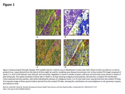
Figure 1 Figure 1. Landsat Thematic Mapper (TM) satellite data for a 6x6-km area in Westch
by cecilia
Beck LR, Lobitz BM, Wood BL. Remote Sensing and Hu...
Joint Center for Satellite Data Assimilation (JCSDA)
by nephewhers
Architects: . Yannick Trémolet. , Thomas Auligne....
PRODUCTION AND ACCESS TO SCIENTIFIC DATA IN AFRICA
by evadeshell
A Framework for Improving the Contribution of Rese...
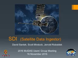
SDI (Satellite Data Ingestor
by startlecisco
). David Santek, Scott . Mindock. , Jerrold Robaid...
JCSDA Science Workshop on Satellite Data Assimilation
by mudth
June 5-7, 2013, NCWCP, College Park, MD. Utility o...
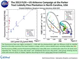
The Fluorescence Ratio was highly correlated (r = 0.96) with the photosynthetic Light Use Efficiency (LUE) for AM/PM data (
by calandra-battersby
The Fluorescence Ratio was highly correlated (r =...
How new and emerging data sources might strengthen Human De
by ellena-manuel
Third Conference on Measuring Human Progress . Ca...
International Network for Sensor InTercomparison and Uncertainty assessment for Ocean Colour Radiometry (INSITU-OCR)
by eren916
S. ensor . I. n. T. ercomparison. and . U. ncerta...
Outdoor Recreation Satellite Account: National and State Statistics 2012-2020 Outdoor Recreation Roundtable Briefing
by jaziel408
National and State Statistics 2012-2020. . Outdoo...
The System of National Accounts Staying on Track Robin Lynch
by yusuf
basics of the national accounts system – market ...
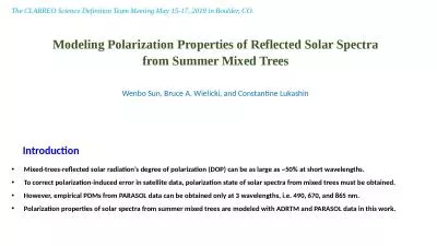
Modelin g Polarization Properties of Reflected Solar Spectra from
by eddey
Summer Mixed. Trees. . Introduction. Mixed-...
Wave and Surge Structural Damage to Shorefront Residential Properties from Hurricane Sandy
by jocelyn
Andrew Kennedy. University of Notre Dame. Ning. L...
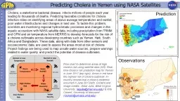
Predicting Cholera in Yemen using NASA Satellites
by pagi
Cholera, a waterborne bacterial disease, infects m...
Sensor Comparison of Satellite Ocean
by elysha
1Inter-Color Products from GOCI and MODISRuhul Ami...
Joint Polar Satellite System (JPSS)
by beatrice
February 9 , 2015 Program Code 47 0 47 0 - REF - 0...
by medshair
Presented by. Lei Shi. NOAA National Centers for E...
GOES Rebroadcast Services
by unisoftsm
Satya Kalluri, Randy Race, Andrew Royle. GOES-R Gr...
Programming Techniques Joint Center for Satellite Data Assimilation (JCSDA)
by attentionallianz
JEDI Academy . - 10-13 June 2019. The Joint . Effo...
Session 5 Current and Future Polar-orbiting
by enkanaum
Satellite Systems. “. NPOESS Preparatory Project...
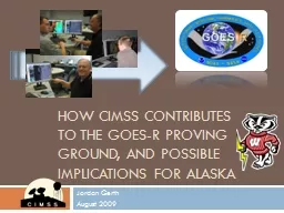
How CIMSS Contributes to the GOES-R Proving Ground, and Possible Implications for Alaska
by unisoftsm
Jordan . Gerth. August 2009. 3 YEARS. of. WFO-DIRE...
Exploring Using Artificial Intelligence (AI) for
by celsa-spraggs
Exploring Using Artificial Intelligence (AI) for ...
Frank Yu Australian Bureau of Statistics
by giovanna-bartolotta
Frank Yu Australian Bureau of Statistics Unstruct...
Exploring Using Artificial Intelligence (AI) for
by karlyn-bohler
Exploring Using Artificial Intelligence (AI) for ...
© Crown copyright Met Office
by stefany-barnette
GODEX-NWP 2017. Nigel Atkinson, . Met Office. 16....
20 July 2016 1 Image classification
by danika-pritchard
From ESA Advanced Training course on Land Remote ...
Developing and Evaluating RGB Composite MODIS Imagery for Applications in National Weather Service
by danika-pritchard
Hayden Oswald. 1. and Andrew Molthan. 2. Univers...
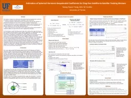
This research is based on the estimation of the spherical harmonic geopotential coefficients for
by ellena-manuel
1. . To develop methods for determining effects o...
Chapter 3 The Media: Conducted and Wireless
by lois-ondreau
Media. The world of computer networks and data co...
Susanne Dieterle - EUMETSAT
by pamella-moone
NAEDEX-26 /. . ASPDEU-14 - October 2015. EUMETSA...
JCSDA OSSEs for Geostationary
by alida-meadow
Hyperspectral. -IR and MW. Sean PF Casey. 12. , ....
An Effort for Improving Reliability of
by briana-ranney
GHG . Monitoring from Space . – . JAXA-NASA Joi...
Chapter 3 The Media: Conducted and Wireless
by sherrill-nordquist
Media. The world of computer networks and data co...
Jed Sundwall, Global Open Data Lead
by natalia-silvester
Messaging Services and Distributed Systems in the...
Copernicus Introduction Bucharest, Romania – 7
by test
th . & 8. th. November 2013. Contents. Intro...
SATELLITES What They Do and
by alexa-scheidler
How They Work. Michael J. Mackowski. Aerospace En...
Resolution Landsat ETM image
by danika-pritchard
Learning Objectives. Be able to name and define t...
MMS Project: "Mid-Atlantic Ocean Model
by karlyn-bohler
Calculations“. Circulation Model. Science Team ...
TEMPO Science Team Meeting May 31, 2017:
by pasty-toler
How Early . A. dopters have Succeeded. Bruce Dodd...
Load More...