Explore
Featured
Recent
Articles
Topics
Login
Upload
Featured
Recent
Articles
Topics
Login
Upload
Search Results for 'satellite data'
satellite data published presentations and documents on DocSlides.
Liaison: CGMS- VLab and WGClimate
by min-jolicoeur
INPE – Hilcéa Ferreira. Agenda . Item . 40. CE...
Introduction to Remote Sensing of the Environment
by alida-meadow
Bot/. Geog. 4111/5111. Ken Driese. Dept. of Bota...
GIS and the use of satellite products for analysis of episo
by test
5. th. TEMPO Science Team Meeting, Cambridge, MA...
Global Positioning System: An Introduction
by myesha-ticknor
David Treharne, n8hku. Ford amateur radio league,...
Atmospheric Sounding with AIRS and ATOVS
by tatiana-dople
Ralf Bennartz . AOS/CIMSS/SSEC. University of Wis...
1 Global Hydro-Estimator Satellite Rainfall Estimates
by aaron
Critical Design Review. September 9, 2011. Prepar...
Influence of Assimilating
by natalia-silvester
S. atellite-Derived High-resolution data on Analy...
Infusing satellite Data into Environmental Applications (
by natalia-silvester
IDEA):. R. Bradley Pierce. NOAA/NESDIS/STAR. PM2....
Where are we now and where are we going?
by stefany-barnette
Capabilities in Remote. Sensing and Air Quality A...
Future Capabilities in Remote
by marina-yarberry
Sensing and Air Quality Applications. Richard Kle...
Current Status of NCEP Conventional and Satellite Observati
by alexa-scheidler
Dr. . DaNa. L. . Carlis. NOAA/NWS/NCEP/EMC. Sept...
Radiometric Calibration of Current and Future Ocean Color S
by phoebe-click
R. Foster, S. Hlaing, A. . Gilerson. , S. Ahmed. ...
1 GOES-R AWG Land Surface Products
by faustina-dinatale
. Land Surface Temperature. Presented By:. Yuny...
Preparing a Satellite for Assimilation
by lois-ondreau
Benjamin Ruston. Steve Swadley, Nancy Baker, . Ro...
Non-Gaussian Based Data Assimilation
by mitsue-stanley
Lecture 1: Theory. Steven J. Fletcher. Cooperativ...
1 Nitrogen Oxides in the Troposphere
by grace3
sources, distributions, impacts, and trends. Lectu...
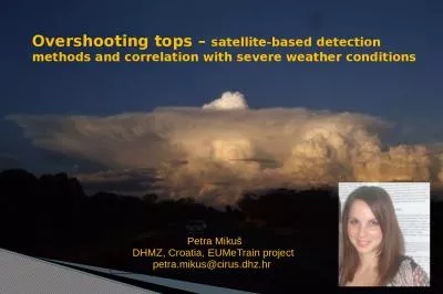
Overshooting tops – satellite-based detection methods and correlation with severe weather condi
by ariel
. Petra . Miku. š. DHMZ, Croatia, EUMeTrain proj...
By- jay patel (130110105027)
by dandy
aakash. . patel. (130110105001). urvish. . soni...
The Lunar Polar Hydrogen Mapper (
by unita
LunaH. -Map) . Mission . and Systems-Level . Statu...
AT 652 – (Satellite) Atmospheric Remote Sensing
by lydia
Course Objectives. To expose students to a broad s...
Prof V N R PillaiFormer ViceChancellorFormer ProViceChancellorPr
by cecilia
Block Preparation TeamDr. Debashish ChakravartyDr....
McIDAS-X and -V at RAMMB/CIRA
by kampsta
. 1. Debra . Molenar . NOAA/NESDIS Regional . and ...
Futuristic view of C4I systems in civil and
by alida-meadow
Futuristic view of C4I systems in civil and de...
Report from CNSA 16 th
by karlyn-bohler
GSICS Executive Panel, Boulder, 15-16 May 2015 ....
Introduction to GNSS Outline
by cheryl-pisano
GNSS . Basics. Common Uses . Precision Agricultur...
1 Establish HR Data Voice Communications Nodes VSAT
by calandra-battersby
VSAT and CAISI . (Very Small Aperture Terminal/. ...
Céline Pasty London, 14 April 2016
by yoshiko-marsland
Focus on Iris: How data is used for the certifica...
3.3.3
by kittie-lecroy
Satellite Communications Systems. RECAP. How many...
MULTIPLE ACCESS TECHNIQUES AND NETWORK ASPECTS
by tatyana-admore
Multiple Access . Aim. is to develop Efficient T...
Yasko
by pasty-toler
Kasai, National . Institute of Information and C...
TELEMETRY,TRACKING AND COMMAND SYSTEM
by olivia-moreira
Presented by. . V.Kok...
Launching
by kittie-lecroy
Next Generation ICT for Weather and Water Informa...
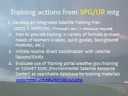
Training actions from
by calandra-battersby
SPG/UR. . mtg. 1. . D. evelop an Integrated Sate...
Satellite phone rentals
by satellitephone
http://www.satellitephonesolutions.com/ | Our web...
Determining the accuracy
by debby-jeon
of . MODIS Sea-Surface Temperatures . – an Esse...
Bomin Sun
by myesha-ticknor
1,2. , A. Reale. 2. , and M. Divakarla. 1,2 . (1)...
THE COMPANY
by faustina-dinatale
ACORDE. . is . a telecommunications company ai...
LECTURING ON SATELLITE IMAGERY PROCESSING AND GIS BASED ON
by lois-ondreau
Fatwa . Ramdani. *. . *. Geo-environment, Instit...
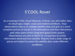
S’COOL Rover
by ellena-manuel
As a roaming S’COOL Cloud Observer, A Rover, yo...
Drew Brandy
by tatiana-dople
Defining Connectivity at Sea. INMARSAT. > Jun...
Load More...