Explore
Featured
Recent
Articles
Topics
Login
Upload
Featured
Recent
Articles
Topics
Login
Upload
Search Results for 'remote sensing'
remote sensing published presentations and documents on DocSlides.
Welcome to the: 35th Tactical Fire Remote Sensing
by linda
Advisory Committee (TFRSAC) Meeting. 1-2 December ...
Fig 1. Sample of ICESat-2/ATLAS Level-3A data product Land Ice Height, Version 1 (ATL06) collected
by arya
Significance:. Forty years of satellite remote sen...
TUZ GL NEW ABSOLUTE RADIOMETRIC CALIBRATION TEST SITE S Gurol H Ozen U
by jainy
Corresponding author Calibration is an important ...
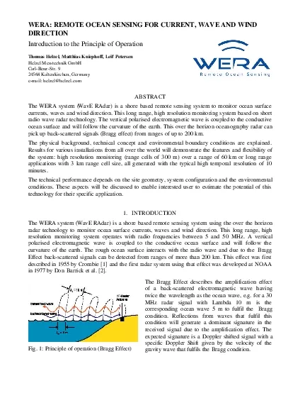
WERA REMOTE OCEAN SENSING FOR CURRENT WAVE AND WINDDIRECTIONIntroducti
by fiona
Fig 1 Principle of operation Bragg EffectThe Bragg...
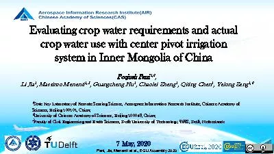
Pani Jia Menenti et al EGU Assembly 2020
by summer
Evaluating crop water requirements and actual cro...
SWARP: Ships and Waves Reaching Polar regions
by delcy
Laurent Bertino, . Timothy . Williams. . Na...
Combining Remote Sensing and Biological Data to Predict the
by agentfor
Consequences of Climate Change on Hummingbird Dive...
Understanding irrigation in India
by cozync
Stefan Siebert and Gang Zhao. Crop Science Group, ...
Wade Crow USDA ARS Hydrology and Remote Sensing Laboratory
by messide
John Bolten. NASA Goddard Space Flight Center . Th...
Wade Crow USDA ARS Hydrology and Remote Sensing Laboratory
by eurolsin
John Bolten. NASA Goddard Space Flight Center . Th...
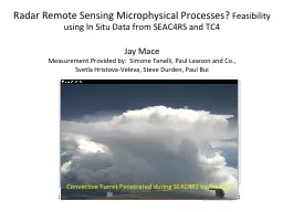
Radar Remote Sensing Microphysical Processes?
by hotmountain
Feasibility using In Situ Data from SEAC4RS and TC...
ALLENDE-PIEDRAS NEGRAS TRANSBOUNDARY AQUIFER: AN INITIAL MODELING ASSESSMENT
by southan
1. Laura Rodriguez Lozada. Rosario Sanchez Flores....
WP4. Brainstorm Statistics
by fluental
-RS component-. Dimitry Van der Zande (RBINS). WP4...
The dark-target aerosol remote sensing from MODIS, circa 2011
by popsmolecules
Robert Levy (SSAI and NASA/GSFC). Shana . Mattoo. ...
Remote sensing in the REDD+ context
by stefany-barnette
Remote sensing in the REDD+ context lessons ...
Abstract: Dryland river basins frequently support both irrigated agriculture and riparian vegetation and remote sensing methods are needed to monitor water use by both crops and natural vegetation in irrigation districts. We developed an algorithm for e
by tatyana-admore
Abstract: Dryland river basins frequently suppo...
A Basic Introduction to Remote Sensing (RS)
by calandra-battersby
Rev. Ronald J. Wasowski, C.S.C.. Associate Profes...
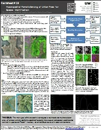
Citation: Kazakova, A.N., L.M. Moskal, and D.M. Styers. 2011
by alida-meadow
. Hyperspectral Remote Sensing of Urban Tress. . ...
Grass-like Crop Canopies
by faustina-dinatale
EECS-823 Phenomenology Presentation. Physical Cha...
Solar Sails for Remote Sensing, Space Weather, and Communications
by marina-yarberry
Ben . Diedrich. NOAA Satellite and Information Se...
Classification of Riparian Buffers in Oregon Using
by test
Several . Object Based Image Analysis Platforms. ...
Mapping Spatial Distribution of Mangrove Species Using High Resolution Multispectral Data
by marina-yarberry
(Presented at SCGIS Conference, Monterey, US, 201...
Capacity Building Activities in Earth Observation at ISRO
by trish-goza
Dr. . A. Senthil Kumar. IIRS/ ISRO. Dehradun, . I...
Analysis of Remote Sensing Data for Tornado Damage Assessment
by ellena-manuel
Presented by: Justin Novak. Advisor: Guido Cerv...
Stochastic Hydrology Random Field Simulation
by danika-pritchard
Professor Ke-Sheng Cheng. Department of Bioenviro...
Some Applications of Remote Sensing and GIS
by marina-yarberry
Xue. . WANG. PhD Candidate. , . Department of Ge...
A View From Afar: The Use of Remote Sensing
by jane-oiler
Technologies to Examine Hopewell . Sites in Ohio ...
RET 2013: Information in Radio Waves
by pasty-toler
Ken Jacobs. Tim . Scaduto. Fundamentals of EM spe...
Sea water dielectric constant, temperature and remote sensing of Sea Surface
by tatiana-dople
Salinity. E. P. Dinnat. 1,2. , D. M. Le Vine. 1....
Combining Remote Sensing and Biological Data to Predict the
by alida-meadow
Consequences of Climate Change on Hummingbird Div...
Combining remote-sensing and biological data to predict the consequences of climate change on hummi
by pamella-moone
Catherine Graham, . Susan Wethington. , Donald Po...
Team RAPTORS Remote Avionics Packet Transceiver with Observational Real-Time Sensing
by faustina-dinatale
Joe Trefilek. Jeff Kubascik. Paul Scheffler. Matt...
Landsat-based thermal change of Nisyros Island (volcanic)
by aaron
November 2014 lava flow on Kilauea (USGS Volcano ...
Graduate GIS programs at the University at Albany
by briana-ranney
James Mower. Department of Geography and Planning...
GEOGG141/GEOG3051 Principles & Practice of Remote Sensing (PPRS)
by kittie-lecroy
Active Remote Sensing: RADAR I. Dr. Mathias (Mat)...
Transferability of land surface model parameters using remote sensing and in situ observations
by sherrill-nordquist
By: Ben . Livneh. Overview. Unified Land Model (U...
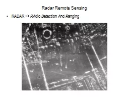
Radar Remote Sensing RADAR =>
by olivia-moreira
RA. dio . D. etection . A. nd . R. anging. Radar ...
Copernicus Introduction Bucharest, Romania – 7
by test
th . & 8. th. November 2013. Contents. Intro...
Disaster Risk Weather and climate events
by ellena-manuel
Exposure. Vulnerability. CONCEPTUAL MODEL . Impac...
Sensible Earth Network
by luanne-stotts
: . Enhancing Access to Earth Observations for So...
Load More...