Explore
Featured
Recent
Articles
Topics
Login
Upload
Featured
Recent
Articles
Topics
Login
Upload
Search Results for 'remote resolution'
remote resolution published presentations and documents on DocSlides.
1 Satellite Remote Sensing of Tropospheric Composition
by carneos
Principles, results, and challenges. Lecture at th...
Remote Sensing: Sensor Resolutions &
by grace3
Colour. Composite. Dr. . Kaustuv. Mukherjee. Ass...
Introduction to Remote Sensing of the Environment
by alida-meadow
Bot/. Geog. 4111/5111. Ken Driese. Dept. of Bota...
Digital Remote Sensing
by lindy-dunigan
The Digital Realm. Orbital characteristics of sen...
Mapping Spatial Distribution of Mangrove Species Using High Resolution Multispectral Data
by marina-yarberry
(Presented at SCGIS Conference, Monterey, US, 201...
Stefan-Boltzmann law governs the radiation of energy by a black body: M = {emissivity} * T
by eve
4. . Emissivity is a constant, so the energy radia...
1 Satellite Remote Sensing I
by mrsimon
UV/vis observations of the troposphere. Lecture at...
Remote sensing data for detection of
by faustina-dinatale
Rhizoctonia solani . in sugar beets. Tavvs M. Alv...
An Introduction to Radar and Lidar Remote Sensing
by conchita-marotz
Credit to: Weile Wang. Gustav Klimt (1862-1918), ...
Product
by pamella-moone
. Roadmap. 11/Q4. . ~12/Q2. . Product. . Plan...
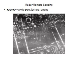
Radar Remote Sensing
by ellena-manuel
RADAR => . RA. dio . D. etection . A. nd . R. ...
Coupling Eddy Covariance Measurements with Remote Sensing t
by phoebe-click
Estimates . of net carbon exchange at broad spati...
Radar Remote Sensing RADAR =>
by olivia-moreira
RA. dio . D. etection . A. nd . R. anging. Radar ...
GEOGG141/GEOG3051 Principles & Practice of Remote Sensing (PPRS)
by kittie-lecroy
Active Remote Sensing: RADAR I. Dr. Mathias (Mat)...
GIS Training Introduction to Remote Sensing
by ariel
Satellite imagery. Low resolution satellite imager...
Working Group: Data Products and Access
by lewis808
Robert Cook, . Oak Ridge National Laboratory. Terr...
MODIS Leaf Area Index (LAI) and Fraction of Vegetation Absorbed
by williams
Photosynthetically. . Active Radiation Products (...
Weather Forecasting 7 predicting the weather over the coming days
by reagan
Last week, we moved away from background science t...
Module 9: Address Resolution
by finley
Introduction to Networks v7.0 (ITN). Module Object...
SWARP: Ships and Waves Reaching Polar regions
by delcy
Laurent Bertino, . Timothy . Williams. . Na...
A Basic Introduction to Remote Sensing (RS)
by calandra-battersby
Rev. Ronald J. Wasowski, C.S.C.. Associate Profes...
Canvas Integration Canvas Integration
by tatyana-admore
Canvas Integration. Canvas Integration. Canvas In...
Curved TV Training
by trish-goza
One Sentence USP. The Wider View, More Splendid E...
NET WORKING (2)
by liane-varnes
Dr. Andy Wu. BCIS . 4630 Fundamentals of IT Secur...
Load More...