Explore
Featured
Recent
Articles
Topics
Login
Upload
Featured
Recent
Articles
Topics
Login
Upload
Search Results for 'map soil'
map soil published presentations and documents on DocSlides.
“Updates of K factor, T factor, and Hydrologic Soil Groups
by marina-yarberry
in the Maryland Soils Database”. Presented by J...
RI Site Specific Soil Mapping Standards and Procedures
by alexa-scheidler
Understanding Hydrologic Soil Groups and Site Spe...
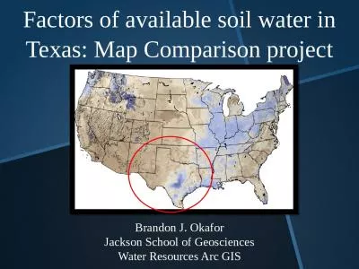
Factors of available soil water in Texas: Map Comparison project
by harmony
Brandon J. . Okafor. Jackson School of Geosciences...
Gibi Soil Mapping LLC
by jaena
John Gibi, LPSS 2103 Donna Kaye Court Mount Juliet...
Managing Soil to Keep It Productive
by yoshiko-marsland
Developed by: . Hudson . Minshew. Oregon State Un...
Soil Water
by trish-goza
Topics. Soils. Soil water properties. Soil water ...
Hydric Soil AND THE FARM BILL
by conchita-marotz
Use of the Definition, Criteria, Field Indicators...
How to create Nitrate Leaching Potential
by faustina-dinatale
(. WA) Maps and Reports from Web Soil Survey. htt...
Spatial Disaggregation – A Primer
by stefany-barnette
Tom . D’Avello. – . NRCS-NSSC-GRU. c. ontact...
How to create Nitrate Leaching Potential
by briana-ranney
(. WA) Maps and Reports from Web Soil Survey. htt...
Vulnerability map of the Edwards Aquifer
by trish-goza
Rami . Harfouch. November 2009, Austin. The Edwar...
Preparing input for the TOPKAPI (
by liane-varnes
TOPographic. Kinematic Approximation and Integra...
The Carbon Navigator
by liane-varnes
How can we maximise the adoption of “green” m...
Precision Farming
by tawny-fly
Mapping EC with . Veris. Bobby Grisso. Virginia T...
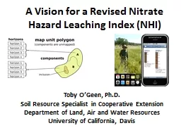
A Vision for a Revised Nitrate Hazard Leaching
by lindy-dunigan
Index (NHI). Toby O’Geen, Ph.D.. Soil Resource ...
Soil Data Viewer 6.0
by briana-ranney
for ArcGIS 10.0. 2013 IGIC Conference. Muncie, In...
Welcome!
by faustina-dinatale
Please sit with your group members. Discipleship ...
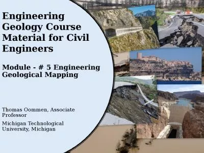
Module - # 5 Engineering Geological Mapping
by helene
Thomas Oommen, . Associate Professor. Michigan Tec...
PROPERTY INSPECTION AND ANALYSIS: THE SITE
by celsa-spraggs
Chapter . 6. CHAPTER TERMS AND CONCEPTS. Access. ...
Ecosystems & Organisms
by luanne-stotts
A place in the natural environment where living ...
EXPLAIN PERIGLACIAL FEATURES AND LANDFORMS
by natalia-silvester
PERMAFROST. SOLIFLUCTION. THERMOKARST. PATTERNED ...
The Ghost Map:
by giovanna-bartolotta
Appears on page 189 facing the chapter called . T...
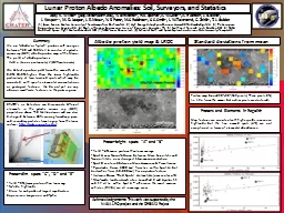
Lunar Proton Albedo Anomalies: Soil, Surveyors, and Statist
by alexa-scheidler
Jody . K. . Wilson. 1. (jody.wilson@unh.edu), N....
Aerial Photography for Geologic Mapping and Analysis
by sherrill-nordquist
Astronaut Video: . Sarychev. Volcano Eruption. ...
Lead Contamination in Bell Hill:
by sherrill-nordquist
Known and Unknown. Shane Capra. Lead in the Soil-...
Aerial Photography for Geologic Mapping and Analysis
by marina-yarberry
Textbook for geologists (2002). Geologic map of t...
SEMBODAI RUKMANI VARATHARAJAN ENGINEERING COLLEGE
by calandra-battersby
DEPARTMENT OF CIVIL ENGINEERING. FOUNDATION ENGIN...
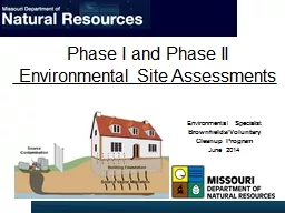
Phase I and Phase II
by cheryl-pisano
Environmental Site Assessments. Environmental . S...
Remote Sensing
by luanne-stotts
for Geologic Mapping and Analysis. Using spatial ...
PROPERTY INSPECTION AND ANALYSIS: THE SITE
by karlyn-bohler
Chapter . 6. CHAPTER TERMS AND CONCEPTS. Access. ...
Arid Ecohydrology Ecohydrology
by phoebe-click
Fall . 2017. A Global Issue…. Huge extent (40% ...
Crossing Disciplinary Boundaries between
by cheryl-pisano
Stratigraphy . and . Geomorphology. to analyze Sl...
1 IntroductionPotentially pathogenic mycobacteria also referred to a
by brianna
tinental flight. Non-tuberculous mycobacteria can ...
Tectonically enhanced
by quinn
geogenic. radon (TEGR). 1. School . of Natural Sc...
Load More...