Explore
Featured
Recent
Articles
Topics
Login
Upload
Featured
Recent
Articles
Topics
Login
Upload
Search Results for 'map gis'
map gis published presentations and documents on DocSlides.
1 INTRODUCTION
by min-jolicoeur
Cartography I
by lindy-dunigan
LECTURE 1. Cartography I. History of Cartography....
ASSET TRACKING
by tawny-fly
CRAVE INFOTECH. . CRAVE INFOTECH - Overview. Ind...
Maps and GIS
by alida-meadow
Historical Maps. The oldest map?. Konya . town ma...
Coordinate Systems,
by briana-ranney
Datums. and Map . Projections. D’Arcangelis. 1...
NABARD WADI
by tatyana-admore
GIS MIS. NATIONAL CENTRE FOR HUMAN SETTELMENT AND...
Applied Cartography and Introduction to GIS
by tatiana-dople
GEOG 2017 EL. Lecture-5. Chapters 9 and 10. Commo...
TURFWAY RD
by susan2
! . ! . ! . ! . ! . ! . CONRAD LN M A L L R D INTE...
NERP 2016
by jane-oiler
Improving the Health of Electoral Rolls. Improvin...
Mark Yandrick Mark Yandrick
by test
2018 Ohio GIS Conference. Enlightening Rounds. Do...
Slope Shading Techniques for
by jane-oiler
LiDAR. Visualization. Thomas J. Pingel. Departme...
GIS in Water Resources Midterm Review 2018
by cheryl-pisano
Blooms Taxonomy of Educational Objectives. 2. Com...
Property Valuation Training & Procedures Commission
by lindy-dunigan
Tax Map Advisory Committee. Kurt . Donaldson, . G...
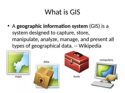
What is GIS A geographic information system
by hadley
(GIS) is a system designed to capture, store, mani...
Maps and GIS Historical Maps
by melanie
The oldest map?. Konya . town map, Turkey, c. 6200...
BROCK UNIVERSITY MAP DATA GIS LIBRARY Referenci ng G
by min-jolicoeur
brPage 1br BROCK UNIVERSITY MAP DATA GIS LIBRARY...
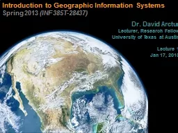
Introduction to Geographic Information Systems
by tawny-fly
Spring 2013 . (INF 385T-28437). . Dr. David Ar...
Shuming Bao
by pasty-toler
China Data Center. University of Michigan. Spatia...
GEOGRAPHY TOOLS
by luanne-stotts
PROJECT 01 - LESSON 01. WHAT ARE THE DIFFERENT TY...
From GPS and Google Maps
by min-jolicoeur
to Spatial Computing. June, 2016. Shashi. . Shek...
Literary Road Trips: GIS and Digital Mapping Tools
by briana-ranney
NEALLT 2016. Motivating . Students with Media, Ga...
CSF Intern
by alida-meadow
Programme. :. H. onorary Interns. Sandra L. . Arl...
Proposal
by lindy-dunigan
to contribute to . Freeman . Ranch. Sara . Dunlap...
Week 4
by phoebe-click
JPL Snow Server. Chris . Mattmann. , Thomas H. Pa...
Jim Irvine
by trish-goza
Head of Digital Resources and the Collins Newsroo...
Facetted browsing of Rockcarvings
by lindy-dunigan
Fredrik Palm, HUMlab . 2012. How does ”Hacka”...
Proposal
by conchita-marotz
to contribute to . Freeman . Ranch. Sara . Dunlap...
GIScience: The Next 10 Years
by yoshiko-marsland
Michael F. Goodchild. University of California. S...
Lecture Materials by Austin
by alida-meadow
Troy, Brian Voigt and . Weiqi. Zhou . except whe...
Introduction to Geographic Information Systems
by tatyana-admore
Spring 2013 . (INF 385T-28437). . Dr. David Ar...
Using GIS to Analyze Movement of Tiger Sharks
by mitsue-stanley
Shark Tags. SPOT. http://www.hawaii.edu/himb/Reef...
Crossing Disciplinary Boundaries between
by cheryl-pisano
Stratigraphy . and . Geomorphology. to analyze Sl...
Some Applications of Remote Sensing and GIS
by marina-yarberry
Xue. . WANG. PhD Candidate. , . Department of Ge...
Using GIS to Make Project Data More Accessible to Employees of an Electrical Engineering Consulting
by danika-pritchard
Karen Rauschert. Advisor: Jim Detwiler. GEOG 596A...
Intersection of Big Data, Analytics, and GIS
by olivia-moreira
James Pick and Namchul Shin. 1. Definition of Spa...
Children’s Medicaid Accessibility with GIS in South King County
by olivia-moreira
Youth Medicaid Alliance. In Partnership with Nort...
MnTOPO – A place to view, print, and download LiDAR Elevation Data
by cheryl-pisano
MnTOPO – A place to view, print, and download L...
Establishments of Bridgehead for Policy Export and International Relations:
by narrativers
Digital . e-governance of Seoul Metropolitan Gover...
New technologies used in 2010 Census Round Polish case study
by slygrat
Janusz Dygaszewicz. Director of Central Census Bur...
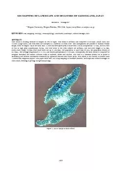
GIS MAPPING OF LANDSCAPE AND DISASTERS OF SADO ISLAND JAPAN Hiromits
by unita
Figure 1. ALOS Image of Sado Island 1429 The Inte...
Load More...