Explore
Featured
Recent
Articles
Topics
Login
Upload
Featured
Recent
Articles
Topics
Login
Upload
Search Results for 'land data'
land data published presentations and documents on DocSlides.
Eloi OUEDRAOGO Statistician, Agricultural Census
by conchita-marotz
Eloi OUEDRAOGO Statistician, Agricultural Census T...
Green National Accounting System in India: Conceptual Issues and Measurement Problems
by oakley
Conceptual Issues and Measurement Problems. S. Sur...
1 Joint Center for Earth Systems Technology, University of Maryland Baltimore County, and NASA Go
by joanne
Center. , Greenbelt, Maryland, . USA. 2. Charles ....
MODIS Leaf Area Index (LAI) and Fraction of Vegetation Absorbed
by williams
Photosynthetically. . Active Radiation Products (...
FAO Work in the Area of Gender Statistics
by white
FAO & Gender. 2 main . areas of work in which ...
Automated Grid Generation for WAVEWATCH III
by paige
Arun. . Chawla. The WAVEWATCH III Team + friends....
VEGA-GEOGLAM Web-based GIS for crop monitoring
by caroline
and decision support . in agriculture. Evgeniya . ...
Spatiotemporal dynamics and determinants of leptospirosis in northeastern Thailand, 2000-2014
by DreamerDollface
Katharine A. Owers. 1. , . Soawapak. Hinjoy. 2. ,...
The detection of irrigation through remote sensing soil moisture and a land surface model: a case
by PeacefulPassion
Jacopo . Dari. . (1). , Pere Quintana-. Seguí. ...
LAND BASED INVESTMENT STRATEGY
by TropicalParadise
Timber Supply Mitigation Assessment Fertilization....
Agricultural Activity Data Requirements for National Emission Inventories
by BabyDolly
Dr. Bernard Hyde, EPA. Climate Change and Environm...
AMR modelling and data analysis
by piper
Andrew Mead. Applied Statistics Group. NERC Enviro...
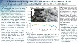
Fig 1. Sample of ICESat-2/ATLAS Level-3A data product Land Ice Height, Version 1 (ATL06) collected
by arya
Significance:. Forty years of satellite remote sen...
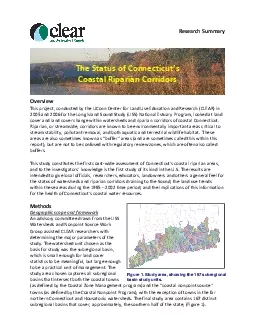
framework
by erica
NonpointassistedCLEARresearchersparametersunitstud...
The Windmill
by jainy
jjjOOOCARd3500350035003500350035003500350035003500...
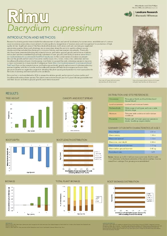
Reasons for planting native trees include the enhancement of plant and
by scarlett
imuDacrydium cupressinumOccurrenceThroughout North...
that will pilot data collection on individual level asset ownership an
by riley
xplore ways of improving the quantity, quality, ty...
e 161 De 1 4 and T5 e De is the spectral variation of emissi
by alyssa
(2) where q is the satellite observation angle an...
BEFORE METHOD The fuzzy edges of paradigmatic
by lindsaybiker
knowledges. Analytic Tactics. Destabilizing stable...
A Hyperspectral network for ocean colour validation
by mrsimon
by Kevin Ruddick,. Royal Belgian Institute for Nat...
LCLUC Webinars NASA LCLUC
by keywordsgucci
CEOS WGCapD-8 Annual Meeting . Agenda Item . 12. W...
LUCAS pilot study on
by cozync
p. rovision. . of. . harmonized. . land. . cov...
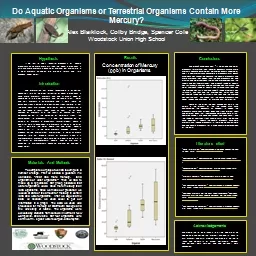
If we test to see if terrestrial organisms or aquatic organisms have more mercury then the aquat
by slygrat
methylation. . . Methylation. is how mercury chan...
SAI DECISION DASHBOARDS
by boyplay
Bringing evidence to bear on negotiating ecosystem...
Spatial Risk Factors for
by fluental
West Nile Virus Positivity . in Mosquitoes . in In...
Although the first image that most people have of oil and natural gas development is a drilling ri
by cheryl-pisano
:. INTRODUCTION. Finding the right geology.. Leas...
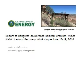
Report to Congress
by trish-goza
Report to Congress on Defense-Related Uranium M...
SPEAR Surveying and Planning through Electronic Applications and Referrals
by pamella-moone
SPEAR Surveying and Planning through Electronic A...
Overview of the Stormwater Nitrogen and Phosphorus Accounting Tool
by sherrill-nordquist
Overview of the Stormwater Nitrogen and Phosphoru...
Water Quality and Development in Hill Country
by min-jolicoeur
. Jesse Libra. CE 394K. Flying J . Junction . Si...
Presented by: Craig Amey, PS
by pamella-moone
GEOG. 596:. Adviser: Dr. Frank Derby. A Python-B...
Water Quality and Development in Hill Country
by celsa-spraggs
. Jesse Libra. CE 394K. Flying J . Junction . Si...
Data Guided Discovery of Dynamic Dipoles
by lois-ondreau
1. Dipoles. Dipoles represent a class of teleconn...
Land Preservation & recreation plan (LPRP) 2019 Update
by aaron
Outdoor recreation level of service analysis &...
An Automated, Multi-Criteria, Weighted Overlay Approach to Helicopter Landing Zones
by marina-yarberry
Barry Y. Miller. ESRI International User’s Conf...
An Optimization Method to
by aaron
Merge . Precipitation Products for . Land . Surfa...
‘Debo Oladosu and Keith Kline
by celsa-spraggs
October 6, 2010. Decomposition Analysis of U.S. C...
Community-wide urban stormwater planning utilizing LiDAR, the WinSLAMM model and GIS
by cheryl-pisano
Dan Murphy. Rebecca Gronewold. UNI GeoTREE Center...
Module 1 - Session 3: Using
by briana-ranney
different . frames . to build and use . a Master ...
1 . IMSG at NOAA/STAR;
by stefany-barnette
2. . NOAA/STAR; 3. UMBC JCET; 4. UMD ESSIC; 5. ...
Load More...