Explore
Featured
Recent
Articles
Topics
Login
Upload
Featured
Recent
Articles
Topics
Login
Upload
Search Results for 'imagery data'
imagery data published presentations and documents on DocSlides.
Shoreline Classification
by kittie-lecroy
Research Planning, . Inc. May . 1, . 2012. ESI wo...
Automating Aerial Imaging
by pamella-moone
Christopher . Lippitt. Grant Fraley. The Beginnin...
Designing a M
by stefany-barnette
Designing a Music . CD. Album Cover. Creating a ...
Cognitive Architectures for Virtual Humans
by stefany-barnette
Paul S. Rosenbloom . |. . 6/15/2011. The proje...
HRIT/EMWIN:
by debby-jeon
The Evolution of LRIT and EMWIN. 1. st. DCSRB an...
Designing a M
by tawny-fly
Designing a Music . CD. Album Cover. Creating a ...
Distinguishing vegetation communities
by stefany-barnette
Land . Cover Mapping and Habitat Analysis. Unders...
Sensible Earth Network
by luanne-stotts
: . Enhancing Access to Earth Observations for So...
AmericaView 2016 Update Rick
by danika-pritchard
Lawrence, Emma Bode, Shannon Savage – . Montana...
Estimating Water Levels with Google Earth Engine
by myesha-ticknor
Eileen Lucero. Capstone Proposal. July 26, 2016. ...
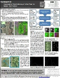
Citation: Kazakova, A.N., L.M. Moskal, and D.M. Styers. 2011
by alida-meadow
. Hyperspectral Remote Sensing of Urban Tress. . ...
Remote Sensing and GIS Application
by hoodrona
Lecturer. Ruba. . Yousif. . Hussain. Third Year....
McIDAS-X and -V at RAMMB/CIRA
by kampsta
. 1. Debra . Molenar . NOAA/NESDIS Regional . and ...
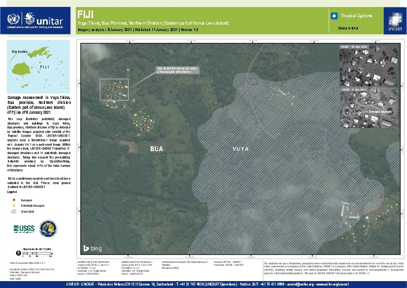
Palais des Nations CH1211 Geneva 10 Switzerland T 41 22 767 4020
by erica
UNITAR-UNOSATHotline 24/7 41 75 411 4998 - unosatu...
An Overview of Satellite Imagery
by beatrice
ARSET - AQ. A. pplied. . R. emote. . SE. nsing. ...
Load More...