Explore
Featured
Recent
Articles
Topics
Login
Upload
Featured
Recent
Articles
Topics
Login
Upload
Search Results for 'gis data'
gis data published presentations and documents on DocSlides.
Our office assists in the local redistricting process (Produced a guide, developed a GIS applicatio
by stefany-barnette
Serves as the official repository for Voting Prec...
Prepared by: Jennifer McKee
by karlyn-bohler
With support from:. in partnership with:. Introdu...
What Does MS4 Mean to You?
by danika-pritchard
A study of sewer and storm drain cross contaminat...
Craig Robinson Harnessing Configuration
by jane-oiler
for web GIS Application Development. June 4, 2014...
APPs FOR GPS Chad Sperry, GIS Center
by aaron
Donghee. . Koh. , PowerPoint Extraordinaire. Nev...
Prepared by: Jennifer McKee
by karlyn-bohler
With support from:. in partnership with:. Introdu...
Utility Technologies, LLC
by yoshiko-marsland
Technology Solutions for Efficient Utilities. Mob...
GIS Analysis of Commercial
by tatyana-admore
Trucking Movements from a Canadian Perspective. G...
Slope Shading Techniques for
by jane-oiler
LiDAR. Visualization. Thomas J. Pingel. Departme...
APPs FOR GPS Chad Sperry, GIS Center
by lindy-dunigan
Donghee. . Koh. , PowerPoint Extraordinaire. Nev...
Jesse Greenough Ryan Mun
by olivia-moreira
Adnan Shabir. Stephany Wei. Where can an Onsite W...
Web Map Applications: The Geo-Web Revisited
by faustina-dinatale
IT4GIS. Keith T. Weber, GISP. GIS Director. ISU-G...
Septic Tank Conversion Prioritization using GIS in the Wakulla Springs Springshed
by lindy-dunigan
Jamie Hughes. Barry Evans, Advisor. SHRUG GIS 201...
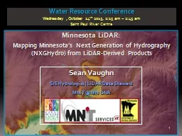
Minnesota LiDAR: Minnesota
by danika-pritchard
LiDAR. Wednesday , November 4. th . 2015, 1:00 pm...
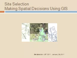
Site Selection Making
by alexa-scheidler
Spatial Decisions Using GIS. January 26, 2011. Si...
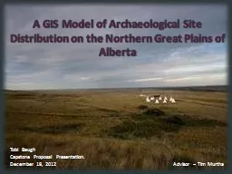
12/19/2012 1 A GIS Model of Archaeological Site Distribution on the Northern Great Plains of Albert
by briana-ranney
Tobi Baugh. Capstone Proposal Presentation. . De...
Municipal Planning & Management with
by alida-meadow
GeoMedia. ®. Smart . Client. Brandon Tourtelott...
Maryland state highway administration (
by myesha-ticknor
sha. ) . experience and perspective. FHWA . Trans...
Computer Software V103.02
by debby-jeon
material obtained from summer workshop in . Guild...
Understanding Earthquakes with GIS
by trish-goza
William Mackaness, Carol Blackwood, Charlotte Gra...
Online real-time tweets extraction, mapping and dissemination
by briana-ranney
Xiannian Chen and Gregory . Elmes. West Virginia ...
Impact of Fluoride Concentrations on Natural Waters throughout Texas
by danika-pritchard
Mark . Stehouwer. GIS in Water Resources. Fall 20...
Introduction to Geographic Information Systems
by tawny-fly
Spring 2013 . (INF 385T-28437). . Dr. David Ar...
Potential Terrorism Targets in Washington, DC
by trish-goza
An . Assessment. Hawk McMahon, Alison Regan, Noel...
Roberto Lucchi
by olivia-moreira
Esri. INSPIRE Discovery, View and Download and OG...
Cycloplan
by ellena-manuel
Work by James Andrew, Landon Bouma, and Loren Ter...
Stormwater utility management system (SUMS)
by marina-yarberry
GIS Application with Web Service Data Access. Int...
Carl Stearns, GISP,
by danika-pritchard
PLS. Corey White, Developer. City . of Raleigh Pu...
AHA 2014, Getting
by tatiana-dople
Started in Digital . History. Spatial History &am...
Using ArcGIS ModelBuilder for Conservation & Ag Drainag
by calandra-battersby
Janell Weiss. Nutrient Mgmt. Specialist/Ag Techni...
Proposal
by lindy-dunigan
to contribute to . Freeman . Ranch. Sara . Dunlap...
Katy Morris: Project Manager
by tatiana-dople
Nick Down: Assistant Manager. Travis Hamel: GIS A...
BROCK UNIVERSITY MAP DATA GIS LIBRARY Referenci ng G
by min-jolicoeur
brPage 1br BROCK UNIVERSITY MAP DATA GIS LIBRARY...
DECISION-MAKING
by sherrill-nordquist
SYSTEMS. Decision Support Software. Reasons for t...
HEC & GIS Modeling of the Brushy Creek Watershed
by pasty-toler
Presented by Cassandra Fagan 25, November 2014. h...
Extending ArcGIS using programming
by tawny-fly
David . Tarboton. GIS in Water Resources. 22 Octo...
Proposal
by conchita-marotz
to contribute to . Freeman . Ranch. Sara . Dunlap...
AHA 2014, Getting
by lindy-dunigan
Started in Digital . History. Spatial History &am...
Hydro Networks in GIS
by alexa-scheidler
Network model. Flow on Networks. Hydrologic netwo...
Maps and GIS
by alida-meadow
Historical Maps. The oldest map?. Konya . town ma...
Load More...