Explore
Featured
Recent
Articles
Topics
Login
Upload
Featured
Recent
Articles
Topics
Login
Upload
Search Results for 'geographic data'
geographic data published presentations and documents on DocSlides.
GEO 241: Geographic Information Systems I
by luanne-stotts
Week 8. : . R. aster Data Model. G...
Analyzing Railroad Accidents Using Geographic Information S
by min-jolicoeur
Subhay. . manandhar. Geographic Information Syst...
Federal Geographic Data Committee Federal Geographic Data Committee February Financing the NSDI National Spatial Data Infrastructure The report Financing the NSDI National Spatial Data Infrastructur
by marina-yarberry
The report has been delivered to the FGDC by Urba...
Using Citizen Science and Volunteered Geographic Information to Augment Biological Collections Data
by pamella-moone
J Ryan Allen. Advisor: Joe Bishop. Background. Un...
Volunteered Geographic Information (VGI) and communicating
by alexa-scheidler
Krista Jones. 1. , Rodolphe Devillers. 1,2. , Yva...
Geographic Information Systems
by ellena-manuel
Department of Surveying and . Geomatics. By Shoko...
GIScience: The Next 10 Years
by yoshiko-marsland
Michael F. Goodchild. University of California. S...
Geographic tools and resources
by liane-varnes
MEASURE . Evaluation. Lesson Objectives. Showcase...
GIS (Geographic Information Systems)
by ellena-manuel
Applications in marketing. Austin College. April ...
The Geographic Support System Initiative
by giovanna-bartolotta
(GSS-I) Partnership . Program. Wes Flack. U.S. Ce...
What is a GIS? Geospatial technologies are technolo-gies for collecting and dealing with geographic
by tawny-fly
three main types: . . Global Positioning Systems...
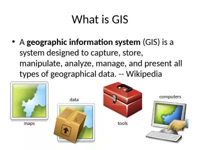
What is GIS A geographic information system
by hadley
(GIS) is a system designed to capture, store, mani...
The Census Bureau's Geographic Support System Initiative
by mitsue-stanley
– An Update. Council of Professional Associatio...
New York “Micro
by mudth
1 - Cluster” Strategy October 21, 2020 Executive...
Citizens as Sensors: The World of Volunteered Geography
by tawny-fly
Michael F. . Goodchild. GeoJournal. (2007) 69:21...
Amalgamate Without Debate
by yoshiko-marsland
By: Kiernan Rennie. Introduction. For those of yo...
Geographic Programs Supporting the 2020 Census
by yoshiko-marsland
Address List Maintenance 2010 - 2020. 5. 2010 Cen...
Geographic Oversampling for Race/Ethnicity Using Data from the 2010 Census
by kittie-lecroy
Presented to . WSS. Sixia Chen. December 3, 2014 ...
September 14, 2017 Use of Geographic Data in COP Planning: South Sudan Experience
by myesha-ticknor
2017 PEPFAR Data and Systems Applied Learning Sum...
Geographic Information Systems - GIS
by ashley
Jessica Griffin. Intro to GIS. Geography is the sc...
Geographic variation in mycobacterial genotypes and tuberculosis disease
by evelyn
Kirsten Wiens. IDM Symposium. 04/17/2018. E. pidem...
Chapter 1 INTRODUCTION Lecture Notes by Dorrell, Henderson, Lindley, & Connor.
by naomi
Introduction to Human Geography (2018). University...
HydroShare: Advancing Hydrology through Collaborative Data
by evelyn
and Model Sharing. David Tarboton, Ray . Idaszak. ...
Geographic Data Primitives
by myesha-ticknor
Large number:. Points, multiipoints, lines, polyl...
Associating Attribute Data In
by pasty-toler
GIS. With support from:. NSF DUE-0903270. Prepare...
GEOGRAPHIC AND DATA CONCEPTS
by maisie
IMPORTANT FOR POPULATION HEALTH. MODULE 2. Module ...
The National Spatial Data Infrastructure (NSDI) Framework is a collaborative initiative to develop
by myesha-ticknor
The National Spatial Data Infrastructure (NSDI) F...
Geographic Information System
by myesha-ticknor
─ . Practice Class. Chan, . Chun-Hsiang. TYF LA...
Quantifying benefits
by aaron
Neil Townsend. 30 January 2017. Context. 2012-14 ...
3. Representing Geography
by tawny-fly
Outline. What is representation?. Digital represe...
Integrating Space-Time Analysis
by calandra-battersby
Michael F. Goodchild. University of California. S...
Geographic Information Systems
by giovanna-bartolotta
Department of Survey and . Geomatics. By Shoko M....
Geographic Data Model
by sherrill-nordquist
Conceptual Model. – a set of concepts that des...
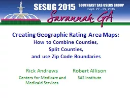
Creating Geographic Rating Area Maps:
by natalia-silvester
How to Combine Counties, . Split . Counties, . &a...
How to make flash cards out of PowerPoint slides!
by tatyana-admore
See slide 8 for details. 1. Which one of these ca...
The Geographic Support System Initiative (GSS-I) Partnersh
by luanne-stotts
Donna Bullock. U.S. Census Bureau. donna.bullock@...
Efficient and effective
by luanne-stotts
result . presentation with GIS. Xiaogang (Marshal...
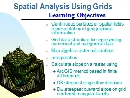
Spatial Analysis Using Grids
by test
Continuous surfaces or spatial fields representat...
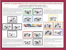
A13B-0219: Geographic
by trish-goza
differences in the vertical structure of the MJO ...
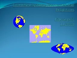
Coordinate Systems,
by briana-ranney
Datums. and Map . Projections. D’Arcangelis. 1...
Load More...