Explore
Featured
Recent
Articles
Topics
Login
Upload
Featured
Recent
Articles
Topics
Login
Upload
Search Results for 'elevation model'
elevation model published presentations and documents on DocSlides.
Terrain Analysis Using Digital Elevation Models (
by celsa-spraggs
TauDEM. ). Learning Objectives. To be able to del...
The Role of Moral Elevation in PTSD and Moral Injury
by davies
Adam McGuire, PhD. Postdoctoral . Fellow. VISN 17 ...
Students make a clay model volcano
by elizabeth
25193028192030321and then create a topographic map...
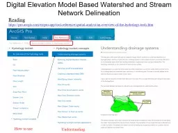
Digital Elevation Model Based Watershed and Stream Network Delineation
by myesha-ticknor
How to use. Reading. . https://. pro.arcgis.com/...
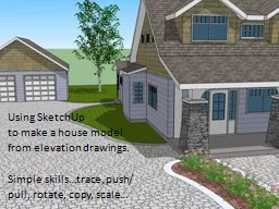
Using
by natalia-silvester
SketchUp. . to make a house model. from elevatio...
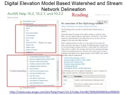
Digital Elevation Model Based Watershed and Stream Network
by olivia-moreira
Understanding. How to use. Reading. http://resour...
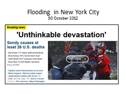
Flooding in New York City
by alida-meadow
30 October 2012. Current Conditions. Projected 5-...
3D and Surface/Terrain Analysis
by faustina-dinatale
in partnership with:. With support from:. NSF DUE...
A distributed glacier model for RASM
by debby-jeon
Jeremy . Fyke. , Bill Lipscomb. Los Alamos Nation...
B-spline Model of Ionospheric Scintillation
by danika-pritchard
11th European Space. Weather Week . Liege, BELGIU...
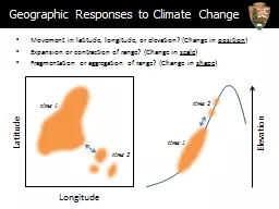
Movement in latitude, longitude, or elevation? (Change in
by olivia-moreira
position. ). Expansion or contraction of range? (...
Terrain Analysis Using Digital Elevation Models
by giovanna-bartolotta
David Tarboton. Utah State University. dtarb@usu....
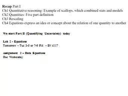
We start Part II (Quantifying Uncertainty) today
by lindy-dunigan
Lab 2 - . Equations. Tomorrow - Tue 3-5 or 7-9 PM...
Methods for Determining Maximum Flood Elevations Landward o
by conchita-marotz
An Example from the Great Missouri . River Flood ...
Copernicus Does he deserve all the historical elevation and fuss about him? Did he change anything
by luanne-stotts
Avoiding the wrath of the Church. Copernicus publ...
Point Extrapolation, Spatial Interpolation,
by aaron
and . Downscaling . of. Climate Variables. Jared ...
Methods for Determining Maximum Flood Elevations Landward of Failed Levees:
by jane-oiler
An Example from the Great Missouri . River Flood ...
Compact Terrain Characterization
by debby-jeon
Background. Surface Creation - Curved Regular Gri...
GIS in Water Resources Watershed and Stream Network Delineation
by cadie
CUAHSI Virtual University. David Tarboton. Utah St...
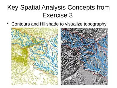
Key Spatial Analysis Concepts from Exercise 3
by susan2
Contours and Hillshade to visualize topography. Zo...
7 AA95 657 ARMY ENGINEER WATERWAYS EXPERIMENT STATION VICKSBURGETC
by amey
TYPE 19 FLOOD INSURANCE STUDY TSUNAMI PREDICTIONS ...
Grapevine Lake Modeling & Watershed Characteristics
by jane-oiler
Nash Mock. Location & Background. Located bet...
Avalanche Risk
by phoebe-click
Terrain Susceptibility. Kyle Renner. GIS in Water...
OURT ARD B MARRIOTT PROTO MODEL DESIGN Site Plan Front Elevation SITE SUMM Building Length feet Building Depth feet Land
by myesha-ticknor
38 acres Parking 120 spaces Data is based on a Gen...
Large Scale Gravity and Isostasy
by karlyn-bohler
Chapter 9. Isostasy: The Concept of Floating Bloc...
NFIE-River: Building a
by liane-varnes
national stream addressing system. Prepared by Xi...
Reservoir and Diversion Data
by tatiana-dople
CBRFC . Stakeholder Forum. July 31, 2012. Model D...
Digital Elevation Model (DEM) Resolution and Stream
by lois-ondreau
Extraction . Using Terrain . Openness . Jos...
Introduction
by mitsue-stanley
Summary. Results. . Approaches. Exploring . i. m...
Load More...