Explore
Featured
Recent
Articles
Topics
Login
Upload
Featured
Recent
Articles
Topics
Login
Upload
Search Results for ''
published presentations and documents on DocSlides.
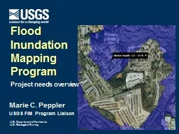
Marie C. Peppler USGS FIM Program Liaison
by mentegor
Flood . Inundation . Mapping. Program. Project nee...
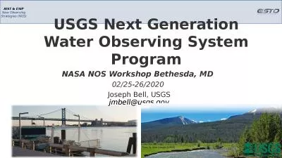
USGS Next Generation Water Observing System Program
by valerie
NASA NOS Workshop Bethesda, MD . 02/25-26/2020 . J...
Marie C. Peppler USGS FIM
by liane-varnes
Coordinator. Flood . Inundation . Mapping. Progra...
USGS Training and Special Projects
by alida-meadow
Training: 3 Annual technical training courses hel...
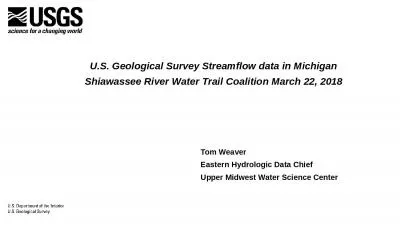
Tom Weaver Eastern Hydrologic Data Chief
by brianna
Upper Midwest Water Science Center. . U.S. Geolo...
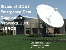
Status of GOES Emergency Data
by pasty-toler
Distribution. Network(EDDN). at EROS. Dan Schwita...
Introduction to ArcGIS Planetary Data Analysis
by min-jolicoeur
Peter Fawdon. Department of Earth and Planetary S...
A Database and Working Group for Cascadia Earthquake Research:
by jovita
Synthesizing Existing Knowledge to Answer Outstand...
USGS Headquarters Update
by danika-pritchard
Tim Newman. Program Coordinator. Land Remote Sens...
USGS Kentucky Water Science Center
by pamella-moone
Potential . CHIA. application for . WATER. (. W....
Status of GOES
by ellena-manuel
Emergency Data . Distribution. Network(EDDN). at ...
Marie C. Peppler
by faustina-dinatale
USGS FIM Program Liaison. Flood . Inundation . Ma...
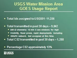
USGS Water Mission Area
by stefany-barnette
GOES Usage Report. Total Ids assigned to USGS01- ...
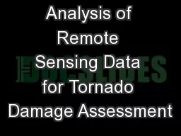
Analysis of Remote Sensing Data for Tornado Damage Assessment
by ellena-manuel
Presented by: Justin Novak. Advisor: Guido Cerv...
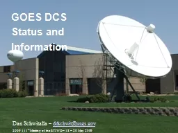
GOES DCS Status and Information
by conchita-marotz
Dan Schwitalla – . ddschwit@usgs.gov. 2009 111....
Hired 959 New Employees
by cheryl-pisano
Processed 27,233 personnel actions (SF-50’s). P...
GOES DCS Status and Information
by faustina-dinatale
Dan Schwitalla – . ddschwit@usgs.gov. 2009 111....
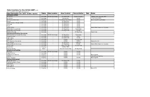
Data Inventory for the GOGA GMP
by gelbero
(built from July 2005 initial GMP GIS data list) ...
Qiang Gao 10/13/2009 3D Terrain Modeling with Real Elevation Data
by elena
A Terrain Snapshot from Demo. A Terrain Snapshot f...
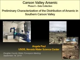
Carson Valley Arsenic Phase II -- Data Collection
by delcy
Preliminary Characterization of the Distribution o...
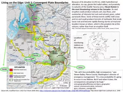
Because of its elevation (4,392 m), relief, hydrothermal alteration, ice cap, glacier-fed radial va
by conchita-marotz
Mount Rainier is the most threatening volcano in ...
Kristi Kline
by olivia-moreira
September 29, 2015. WGISS 40. USGS Plans for Arch...
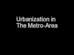
Urbanization in The Metro-Area
by alida-meadow
By:. Reid Swanson. Sam . Soper. Goal: . To descri...
Knowledge Evolution in
by lindy-dunigan
Distributed . Geoscience Datasets and . the Role ...
Stream Gages
by alida-meadow
CBRFC Stakeholder Forum. July 31, 2012. Stream Ga...
The Yellowstone River
by sherrill-nordquist
Flooding in Glendive, MT. By: Clay Woods. Yellows...
Capturing
by trish-goza
Disasters. with Terra . ASTER. 1. Chris . Doesche...
Aberdeen, ID Groundwater Analysis
by pasty-toler
Jerimiah Fenton. Aberdeen Wetlands. During the 19...
Using brackish groundwaters as indicators for potential imp
by trish-goza
Mark Engle, Francisco Reyes. U.S. Geological Surv...
Applications of the U.S. Geological Survey Produced Waters
by pamella-moone
Mark A. Engle. 1. , . Kathleen D. . Gans. 2. , . ...
Ven
by tawny-fly
Te. Chow Award Lecture. David R. . Maidment. ASC...
Qiang
by luanne-stotts
. Gao. 10/13/2009. 3D Terrain Modeling with Real...
GFSAD 30 Website Update
by olivia-moreira
with inputs from:. PRASAD THENKABAIL, Cristina Mi...
July 31, 2012
by tawny-fly
Kevin Werner. NWS Colorado Basin River Forecast C...
Ven
by ellena-manuel
Te. Chow Award Lecture. David R. . Maidment. ASC...
The Effects of Land Cover Change on the Brushy Creek Watershed
by marina-yarberry
CE 397 Statistics for Water Resources. By Ruth Ha...
Jed Sundwall, Global Open Data Lead
by natalia-silvester
Messaging Services and Distributed Systems in the...
Natural Capital Accounting in the United States:
by caitlin
Recent Efforts in Developing Land and Water Accoun...
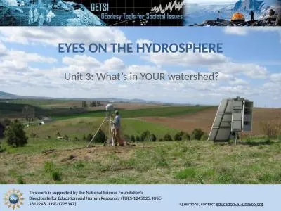
Eyes on the Hydrosphere Unit 3: What’s in YOUR watershed?
by pagi
1.) Navigate to CU Boulder’s Mascon Visualizatio...
Because of its elevation (4,392 m), relief, hydrothermal alteration,
by smith
ice cap. , glacier-fed radial valleys, and proximi...
Load More...