Explore
Featured
Recent
Articles
Topics
Login
Upload
Featured
Recent
Articles
Topics
Login
Upload
Search Results for ''
published presentations and documents on DocSlides.
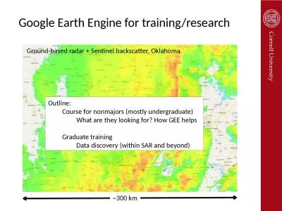
Google Earth Engine for training/research
by maisie
~300 km. Ground-based radar + Sentinel backscatter...
Examining Surface Reflectance, NDVI and LAI from TM, ETM and OLI for Data Fusion and ET Mapping
by alexa-scheidler
Feng Gao, Martha Anderson, Liang Sun, Yang . Yang...
I ntroduction
by kittie-lecroy
NDVI data set. Algorithm. Applications. Summary &...
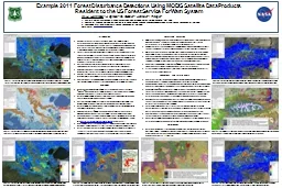
Using a Satellite Drought Indicator for
by morgan
Drought Damage Classification and . Parcel Based C...
e 161 De 1 4 and T5 e De is the spectral variation of emissi
by alyssa
(2) where q is the satellite observation angle an...
Introduction
by alida-meadow
Acquired and applied MODIS NDVI data to compute n...
DEVELOPMENT OF AN IN-SEASON ESTIMATE OF YIELD POTENTIAL UTI
by pasty-toler
2013 NUE Conference. Des Moines, Iowa. August 5-7...
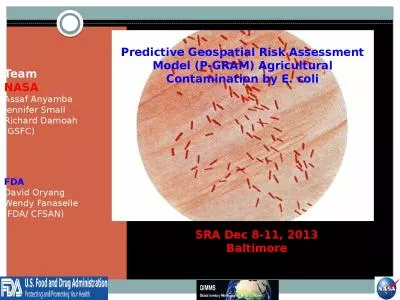
Team NASA Assaf Anyamba Jennifer Small
by anderson
Richard Damoah. (GSFC). FDA. David . Oryang. . We...
Designing index-based insurance for livestock
by lastinsetp
Francesco Fava. International Livestock Research I...
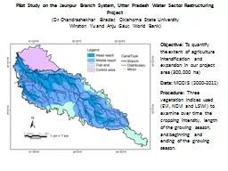
Pilot
by briana-ranney
Study on the . Jaunpur. Branch System, Uttar Pra...
MODIS Retrievals for the Amazon Rainforest
by jane-oiler
Dan . Sauceda. Outline. Information on the Region...
Load More...