Explore
Featured
Recent
Articles
Topics
Login
Upload
Featured
Recent
Articles
Topics
Login
Upload
Search Results for 'data lidar'
data lidar published presentations and documents on DocSlides.
Slope Shading Techniques for
by jane-oiler
LiDAR. Visualization. Thomas J. Pingel. Departme...
Oregon Lidar Data Standard
by jane-oiler
Call for Endorsement. FIT Forum, November 10, 201...
Performance characteristics and design
by pamella-moone
trades for . an ISS . Hybrid Doppler Wind . Lidar...
Mapping Technology
by karlyn-bohler
Overview. Philip Gershkovich. President. Cooper A...
Comparison and merging of ozone profile data from
by littleccas
lidar. and other measurement techniques. S. Godin...
MnTOPO – A place to view, print, and download LiDAR Elevation Data
by cheryl-pisano
MnTOPO – A place to view, print, and download L...
Free Troposphere data sets
by tatyana-admore
Acknowledgement. G. . . Ancellet. , O. R. . Coope...
Two impact studies of airborne DWL data on tropical cyclone
by liane-varnes
G. D. Emmitt, K. Godwin and S. Greco. Simpson Wea...
Automated Tree-Crown Delineation Using
by mitsue-stanley
Photogrammetric Analyses. Austin . Pinkerton * an...
Improving estimates of roughness length (Z
by danika-pritchard
0. ) in a road weather prediction model using air...
Geographical Information Science/Remote Sensing/
by luanne-stotts
Modelling. Research interests . Chris Brunsdon,...
Chris Slinger, John Medley, Rhys Evans
by danika-pritchard
Use of nacelle lidar data . to explore impact of ...
Digital Library
by celsa-spraggs
Presenter: Gary Phelps. Prof. Guo Lab. School of ...
MnTOPO – A place to view, print, and download LiDAR Eleva
by karlyn-bohler
Accessing and Viewing Minnesota LiDAR Data On-lin...
IFSAR and terrestrial LIDAR for vegetation study in Sonora,
by min-jolicoeur
Created for GIS in Water Resources 2013 by Kendal...
Interpolation - applications
by marina-yarberry
Interpolating a temperature surface. 1. Problem. ...
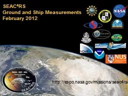
http://espo.nasa.gov/missions/seac4rs/
by warlikebikers
SEAC. 4. RS. Ground and Ship Measurements. Februar...
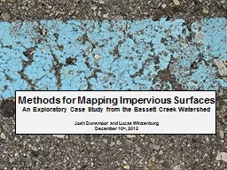
Methods for
by conchita-marotz
Mapping . Impervious Surfaces. An Exploratory Cas...
MANAGING FULL WAVEFORM LIDAR DATA: A CHALLENGING TASK FOR THE FORTHCO
by ellena-manuel
415 The International Archives of the Photogrammet...
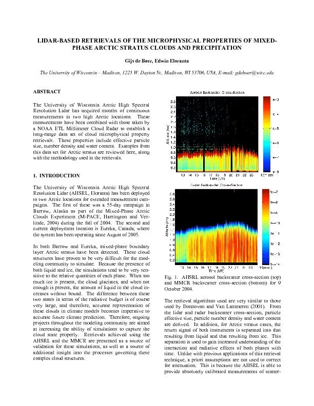
SpectralResolution Lidar has acquired months of continuousmeasurements
by conchita-marotz
establish along-range data set of cloud microphysi...
ASPRS LIDAR Data Exchange Format Standard
by jane-oiler
Files conforming to the ASPRS LIDAR data exchange ...
ASPRS LIDAR Data Exchange Format Standard
by alexa-scheidler
Files conforming to the ASPRS LIDAR data exchange ...
Geoffrey M. Henebry
by tawny-fly
Jordan D. Muss. Eric Ariel L. Salas. Geographic I...
Space Borne and
by ellena-manuel
Ground Based . Lidar. NASA ARSET- . . EPA Train...
Project To Validate a Wind Turbine
by debby-jeon
Turbulence Model. Stephen Wheeler. 7. th. Novemb...
Project To Validate a Wind Turbine
by stefany-barnette
Turbulence Model. Stephen Wheeler. 7. th. Novemb...
Elevation and Hydrography
by myesha-ticknor
A match made on earth. USGS, . SouthAtlantic. Wa...
Oregon Department of Forestry
by yoshiko-marsland
Forest Inventory Systems and Lidar. Operationaliz...
A Fully Automated Approach to Classifying Urban Land Use an
by olivia-moreira
Jason Parent. Qian Lei . University of Connecticu...
3D Archaeological Survey Modeling as a Compliment to Traditional Excavation Methods for Enhanced Vi
by ellena-manuel
By. Paul Roddy. Pennsylvania State University. GE...
PROJECT GRANTED UNDER INDO-EUROPEAN COOPERATION ON RENEWABLE ENERGY
by karlyn-bohler
08 March 2018. 2. Gujarat and Tamil Nadu Full-fea...
Open Source Tools for Treatment of
by yoshiko-marsland
Lidar. Derived Terrain Models. By Marty Earwood....
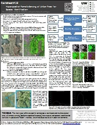
Citation: Kazakova, A.N., L.M. Moskal, and D.M. Styers. 2011
by alida-meadow
. Hyperspectral Remote Sensing of Urban Tress. . ...
Innovation & Collaboration
by pamella-moone
Innovation & Collaboration The SME Perspectiv...
Partnership Opportunities and the Evolving Michigan
by elena
Statewide Authoritative Imagery and LiDAR Program ...
Status of MOLI
by quinn
developmentMOLI Multi-footprint Observation Lidar ...
Citation: Kato, A.., L. M. Moskal., P. Schiess, M. Swanson, D. Calhoun and W.
by taylor
Stuetzel. , 2008. . LiDAR based tree crown surfac...
OIB Sea Ice Workshop Wednesday, 29 January 2014
by eve
NASA Goddard Space Flight Center (GSFC). 1. Radar ...
Geospatial Analysis and Modeling - NCSU MEAS – Helena Mitasova
by ivy
Geomorphometry I: . Terrain modeling. Geospatial A...
The added value of profiling observations from the ground based networks /
by audrey
Lucia Mona - CNR. Second Joint School on Atmospher...
Load More...