Explore
Featured
Recent
Articles
Topics
Login
Upload
Featured
Recent
Articles
Topics
Login
Upload
Search Results for 'Map-Gis'
Map-Gis published presentations and documents on DocSlides.
GIS MAPPING AND VULNERABILITY ASSESSMENT
by roxanne
IN UPHCS OF MADURAI CORPORATION UNDER NUHM . Prese...
Remote Sensing and GIS Application
by blindnessinfluenced
Lecturer. Ruba. . Yousif. . Hussain. Third Year....
What is a GIS? Geospatial technologies are technolo-gies for collecting and dealing with geographic
by tawny-fly
three main types: . . Global Positioning Systems...
Public GIS Viewer Mark Maddox
by pamella-moone
Phyllis Effah Addo-Boafo. August 2017. What is GI...
Beginners Guide: Embed GIS Maps Tutorial
by ellena-manuel
and Walkthrough w/Examples. How to Add GIS Maps t...
Utilization of GIS in Japan
by tawny-fly
Hiroyuki KITADA , Yumi SEKINE. National Statistic...
Ten Years of Gulfport GIS
by kittie-lecroy
Survival and Evolution . since . Hurricane Katrin...
Geographic Information Systems (GIS) – climate hazards
by valerie
Getting started. You’ll need a notepad on which ...
Use of GIS a s a Decision Support System
by belinda
GEOM 4008 - November 2, 2015. Group 2 : Fernanda ....
GIS for Information Technology
by helene
Prepared by . Information . Technology Services . ...
The Geo-Web: Enabling GIS on the Internet
by pamella-moone
IT4GIS. Keith T. Weber, GISP. GIS Director. ISU-G...
Jennifer Lana, GISP GIS Manager
by kittie-lecroy
Cobb County, GA. October 3, 2012. Cobb County use...
Streamlining GIS Data & Solution Management
by phoebe-click
Stephen Hale. GIMS DB Administrator. ODOT. Ohio G...
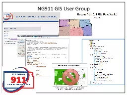
NG911 GIS User Group Led
by trish-goza
by GIS Committee. Quarterly (or as needed) confer...
Part I: GIS Tools for Water Planners
by lois-ondreau
and. Part II: Sierra Nevada Conservancy . GIS Wat...
GIS at a Regional Level
by celsa-spraggs
Regional Planning & Development Councils and...
Winter 2011 GIS Institute
by tawny-fly
Space:. Questions & Tools. First Off: Introdu...
GIS as Applied to Disaster Management in Outlying and Non-M
by alida-meadow
James Cueno, City of Galesburg. jcueno@ci.galesbu...
GIS (Geographic Information Systems)
by ellena-manuel
Applications in marketing. Austin College. April ...
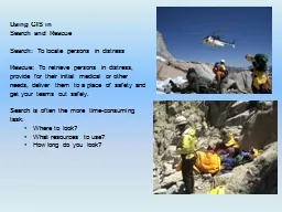
Using GIS in
by cheryl-pisano
Search and Rescue. Search: . To locate persons in...
Chapter 10: Health and GIS
by kittie-lecroy
An Introduction to the Geography of Health. Data ...
GIS Matthew Rosencrans
by test
Tom . DiLiberto. Outline . What is GIS?. What can...
INTEGRATING SURVEYING AND GIS
by yoshiko-marsland
PREPARED FOR:. WVAGP SEMINAR. Jared D. Wilson. In...
Applied GIS On Kuwait’s water
by natalia-silvester
Duaij AlRukaibi. GIS in Water R...
12. Cartography and Map Production
by liane-varnes
Outline. Nature of maps and cartography. Principl...
Treatment of Imatinib -resistant GIST
by beatrice
: . The Next Generation. Dr. Michael Heinrich, M....
A GIS-Based Model to Assess
by fanny
Onsite Sewage . Facility . (. OSSF) . Contaminatio...
Minnesota DNR GIS Service Delivery and Governance
by candy
Tim . Loesch. GIS Section Manager. Camp Ripley. 19...
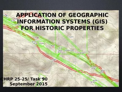
APPLICATION OF GEOGRAPHIC INFORMATION SYSTEMS (gis) FOR Historic properties
by teresa
NCHRP 25-25/ Task 90. September 2015. What is a GI...
Role of GISFI in Global Standardization
by caitlin
Ramjee Prasad . Founding Chairman, GISFI. www.gisf...
Michigan Statewide 911 GIS Repository
by fiona
Data Importer Onboarding Training. Mark Holmes, GI...
A GIS case study Adeline’s dilemma
by heavin
July 29, 2012. James . Daw. Adeline, age 66. Inco...
GIS Quick Tips
by eleanor
Presented by CUC ’ s Uivision of Heart Uisease a...
GIS for NG911 May 18 th , 2022
by Dollface
Thurston County Fairgrounds. Jason Guthrie 360-70...
Kansas NG9-1-1 GIS Data Model
by SupremeGoddess
Model Standards and Data Remediation Workshop. Wel...
Ernesto Gismondi
by alyssa
12FebeDaniele MoioliFEBEERNESTO GISMONDI / DANIELE...
Remote Sensing and GIS Application
by rayfantasy
Lecturer. Ruba. . Yousif. . Hussain. Third Year....
The GIST of making informed decisions and workflow of buying, borrowing, downloading or viewing.
by phoenixbristle
Tim Bowersox, Cyril Oberlander, Kate Pitcher, Mark...
GIS Data Management for
by funname
SHA’s . Bay Restoration Program. Jeff Tirschman,...
Nick Tonias, P.E. A Simplified Approach to Implementing GIS
by shangmaxi
1985. . The CEDRA Corporation is established. . ....
Load More...