Explore
Featured
Recent
Articles
Topics
Login
Upload
Featured
Recent
Articles
Topics
Login
Upload
Search Results for 'Elevation-Model'
Elevation-Model published presentations and documents on DocSlides.
The Role of Moral Elevation in PTSD and Moral Injury
by davies
Adam McGuire, PhD. Postdoctoral . Fellow. VISN 17 ...
Terrain Analysis Using Digital Elevation Models (
by celsa-spraggs
TauDEM. ). Learning Objectives. To be able to del...
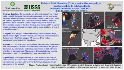
Figure: A national scale relative tidal elevation (Z*) mapping product displayed at diverse well d
by elizabeth
Relative Tidal Elevation (Z*) is a metric that nor...
Angles of elevation & depression
by alyssa
Solve problems involving angles of elevation and a...
Angle of elevation and depression
by gagnon
Warm Up. 1.. . Identify the pairs of alternate . ...
Online Banking System Trust Elevation
by Younggunner
Online Banking Use Cases. Reference: . http://umld...
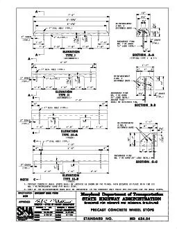
ELEVATION
by elena
TYPE I ELEVATION TYPE II SECTION A-A SECTION B-B E...
ST-Elevation Myocardial Infarction
by danika-pritchard
(STEMI). Greg Johnsen, MD, FACC, FSCAI. Epidemiol...
MnTOPO – A place to view, print, and download LiDAR Elevation Data
by cheryl-pisano
MnTOPO – A place to view, print, and download L...
Kentucky Aerial Photography and Elevation Data Program - KYAPED
by pasty-toler
National Height Mod Partner Meeting. M. ay 1, 201...
ST-Elevation Myocardial Infarction
by pamella-moone
(STEMI). Greg Johnsen, MD, FACC, FSCAI. Epidemiol...
Elevations While a floor plan gives you a view from above, an elevation is a drawn as if someone i
by lois-ondreau
One common use of an elevation is to show the arr...
8.4 Angles of Elevation and Depression
by cheryl-pisano
-Quiz Friday over Pythagorean Theorem/Special Rig...
Day 3: Angles of Elevation and
by natalia-silvester
Depression. 1/14 and 1/15. EQ: . How do we draw ....
Elevation and Hydrography
by myesha-ticknor
A match made on earth. USGS, . SouthAtlantic. Wa...
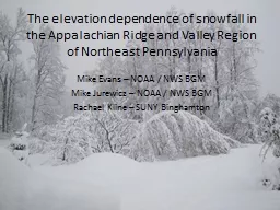
The elevation dependence of snowfall in the Appalachian Rid
by trish-goza
Mike Evans – NOAA / NWS BGM. Mike . Jurewicz. ...
Winter Invertebrate Composition as a Function of Elevation
by min-jolicoeur
How does invertebrate richness, diversity, and ab...
Kentucky Aerial Photography and Elevation Data Program - KY
by myesha-ticknor
National Height Mod Partner Meeting. M. ay 1, 201...
Louisiana Coastal Elevations
by tawny-fly
Slides from Prof. . Roy Dokka. Global sea-level h...
This map shows the elevation in
by trish-goza
meters. Which landforms does this region have?. ...
Qiang Gao 10/13/2009 3D Terrain Modeling with Real Elevation Data
by elena
A Terrain Snapshot from Demo. A Terrain Snapshot f...
Students make a clay model volcano
by elizabeth
25193028192030321and then create a topographic map...
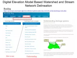
Digital Elevation Model Based Watershed and Stream Network Delineation
by myesha-ticknor
How to use. Reading. . https://. pro.arcgis.com/...
Elevation of Privilege
by luanne-stotts
The easy way to threat model . Adam Shostack. Mic...
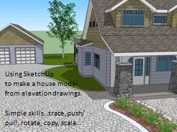
Using
by natalia-silvester
SketchUp. . to make a house model. from elevatio...
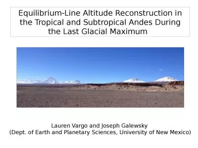
Equilibrium- L ine A ltitude
by zoe
R. econstruction in the Tropical and Subtropical A...
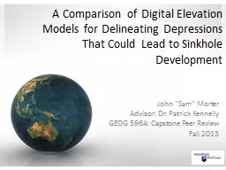
A Comparison of Digital Elevation Models for Delineating Depressions That Could Lead to Sinkhole De
by min-jolicoeur
John “Sam” Morter. Advisor: Dr. Patrick Kenne...
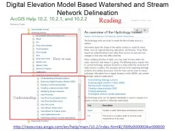
Digital Elevation Model Based Watershed and Stream Network
by olivia-moreira
Understanding. How to use. Reading. http://resour...
Qiang
by luanne-stotts
. Gao. 10/13/2009. 3D Terrain Modeling with Real...
Terrain Analysis Using Digital Elevation Models (
by luanne-stotts
TauDEM. ). David Tarboton. 1. , Dan Watson. 2. , ...
GNSS REFLECTOMETRY FOR SEA SURFACE WIND SPEED ESTIMATION
by tawny-fly
D. . Schiavulli. , F. Nunziata, M. Migliaccio, G....
Elevation of Privilege
by marina-yarberry
:. Drawing Developers . into Threat Modeling. Ada...
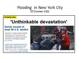
Flooding in New York City
by alida-meadow
30 October 2012. Current Conditions. Projected 5-...
3D and Surface/Terrain Analysis
by faustina-dinatale
in partnership with:. With support from:. NSF DUE...
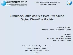
Drainage
by test
Paths . derived. . from. . TIN-based. Digital...
Threat Modelling Kick start your application security with Threat Modelling
by alexa-scheidler
Tonight's agenda . Our focus is always somewhere ...
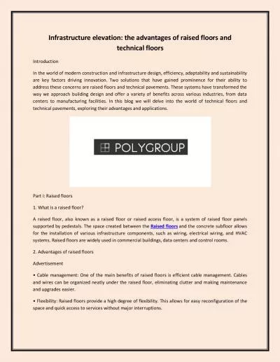
Infrastructure elevation: the advantages of raised floors and technical floors
by ragnarsnakewood
In the world of modern construction and infrastruc...
Elevation, space and host plant species structure
by naomi
Ericaceae. root associated fungal communities in ...
Title Slide Navigation 2 Minute Teaser
by abigail
Elevation validation and geomorphic metric compari...
Right Triangle Trig Applications
by helene
Angles of Elevation and Depression. Dr. Shildneck....
Load More...