Explore
Featured
Recent
Articles
Topics
Login
Upload
Featured
Recent
Articles
Topics
Login
Upload
Search Results for 'Data-Datum'
Data-Datum published presentations and documents on DocSlides.
Streamgage Datum Conversion
by pasty-toler
Great Lakes Region Height Modernization Consortiu...
DWR Streamgage North American Vertical Datum of 1988 Update of October 2019
by camstarmy
July 26, 2019. Mitch Russo, P.E.. Hydrology and Fl...
Modernizing the Geopotential Datum: Replacing NAVD 88
by marina-yarberry
Daniel R. Roman, Ph.D.. Outline. What is a vertic...
autor prezentace, datum prezentace, univerzitní oddělení
by conchita-marotz
Portal. . of. Palacký University. STAG. autor ...
Classes and Objects in C
by eddey
Shahram RahatlouCorso di ProgrammazioneRoma11March...
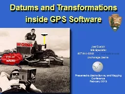
Datums and Transformations inside
by conchita-marotz
I’m in NAD83. WGS84. Joel Cusick. GIS Specialis...
Geodetic Vertical and Tidal
by danika-pritchard
Datums. , focus on South SF Bay, CA. Marti . Ikeh...
Datums, Spheroids and Projections.
by danika-pritchard
What in the world are these all about?. Dr. Ronal...
Agenda, Part II TIDAL DATUMS in the South SF Bay
by tatiana-dople
Computing Tidal . Datums. -Basic tidal computati...
International Great Lakes Datum
by luanne-stotts
& GRAV-D. Presented at a meeting of the . Gre...
Understanding Earthquakes with GIS
by trish-goza
William Mackaness, Carol Blackwood, Charlotte Gra...
Datums and Tides
by celsa-spraggs
Mean Low Tide versus Mean Lower Low Water. And th...
VORF: Vertical Offshore Reference Frame
by jane-oiler
Jonathan Iliffe. Civil, Environmental & . Geo...
LOST IN TRANSFORMATION
by tatyana-admore
WVGIS 2014 Conference. June 2-5, 2014. Christine ...
Unit 3 Spatial referencing
by pamela
TYIT SEM VI. Spatial Reference System. Spatial ref...
F lorida P ermanent R eference
by danika-pritchard
N. etwork. Florida Custom Geoid. and. New . Datum...
Modernizing the Geopotential Datum
by liane-varnes
. AKA “Replacing NAVD 88”. Dru Smith. NSRS ...
Assigned Wheel Hub – GD&T
by natalia-silvester
A STEP BY STEP WALKTHROUGH. What you will need…...
Datums GD&T Drawing Checking
by giovanna-bartolotta
1. 9/4/2014. Daniel Pasholk. I’ll . break . at ...
HOW TO NAVIGATE WHERE FAMILIAR LANDMARKS ARE NOT AVAILABLE
by tatyana-admore
How do I get to where???. Earthquakes, tsunamis, ...
1 The MMC is
by danika-pritchard
68.2 mm, the largest allowable diameter for t...
PMSB Project: RNA-
by min-jolicoeur
Seq. Read Simulation. Titel, Datum. Overview. Th...
Smart Cane – P14043
by marina-yarberry
Systems Design Review. Lauren Bell, Jessica Davil...
Geometric Tolerances & Dimensioning
by conchita-marotz
MANUFACTURING PROCESSES - 2, IE-352. Ahmed M. El-...
Geometric Dimensioning and Tolerancing
by briana-ranney
Other geometric tolerances:. profile. runout. &a...
Coastal Zone 2011 Conference
by calandra-battersby
“. Cool Geodetic Resources For Your Project. �...
Projections and Datums within ArcGIS
by pasty-toler
Melita Kennedy. 2012 Datum Series Sponsored by GP...
Coastal Zone 2011 Conference
by cheryl-pisano
“. Cool Geodetic Resources For Your Project. �...
Windenergie in de regio
by yoshiko-marsland
Mei 2014. Pleij. BV. Programma. Introductie van ...
How to Prepare for Hitachi Vantara HQT-2225 Certification?
by NWExam
Start here--- https://shorturl.at/diI25 ---Get com...
Cohesity COH100 Exam Prep: Important Questions with Answers
by NWExam
Start here---https://shorturl.at/ZPRp9---Get compl...
Importance of Data Collection in Healthcare Systems
by Pubrica106
Learn the importance of data collection in healthc...
RECLAMATION
by holly
Managing Water in the West Lake Waha 2005 Survey U...
2104 Fall AGU Meeting Session: G51B
by evadeshell
Paper: G51B-0353 Fr...
Doing Archaeology Ch 9 A
by tawny-fly
research design . is a systematic plan that ensur...
Using XML Mapper and Enterprise Guide to Read Data and Meta
by myesha-ticknor
Larry Hoyle, Inst. For Policy & Social Resear...
GIS Matthew Rosencrans
by test
Tom . DiLiberto. Outline . What is GIS?. What can...
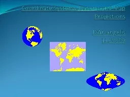
Coordinate Systems,
by briana-ranney
Datums. and Map . Projections. D’Arcangelis. 1...
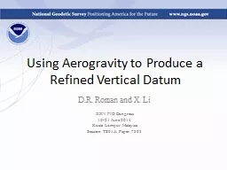
Using Aerogravity to Produce a Refined Vertical Datum
by faustina-dinatale
D.R. Roman and X. Li. XXV FIG Congress. 16-21 Jun...
Geodesy, Map Projections and Coordinate Systems
by pasty-toler
Geodesy. - the shape of the earth and definition...
Load More...