Explore
Featured
Recent
Articles
Topics
Login
Upload
Featured
Recent
Articles
Topics
Login
Upload
Search Results for 'Barcode-Mapping'
Barcode-Mapping published presentations and documents on DocSlides.
Tracking and Traceability for Pipes, Fittings, and Fusions
by briana-ranney
A Partnership between Avista and . LocusView. fo...
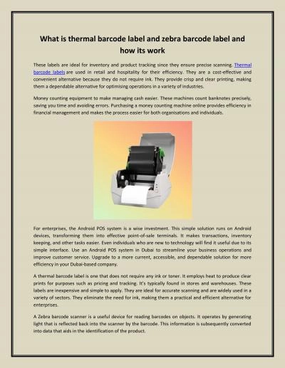
What is thermal barcode label and zebra barcode label and how its work
by neotechae
These labels are ideal for inventory and product t...
How to Select the Best Barcode Scanner for Your Business
by inatecktechnology
A barcode scanner can make your daily business ope...
Barcode Reading Basics 8/15/18
by sherrill-nordquist
What Is a Barcode?. A way to print data that is d...
Barcodes – LO To understand what a barcode is and why they are used
by briana-ranney
To create own . working. barcode design. Video. ...
Foreign Barcode
by marina-yarberry
Definitions. Foreign Barcode (FBC), also known as...
Barcode Reader and Scanner Rental Company
by barcoderental
Our company makes short-term barcode rentals easy...
Barcode Reader and Scanner Rental Company
by barcoderental
PDA WinMobile computers that are optimized for Web...
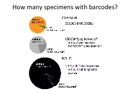
How many specimens with barcodes?
by liane-varnes
How many species with barcodes?. What . groups . ...
Concept Mapping Mind Mapping and Argument Mapping The University of
by mackenzie
these tools may offer educators as yet unrealised ...
Market mapping Market mapping
by giovanna-bartolotta
This section covers the following: . What market ...
Multibeam Mapping The Evolution of Mapping the Ocean
by myesha-ticknor
Lead line mapping. Lead line mapping was the earl...
Chimera User Guide
by wang
April 2021 of 116 Introduction Barcode labels sho...
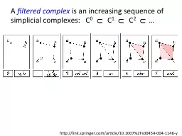
Visualizing Multi-dimensional
by SportyChick
Persistent Homology. Matthew L. Wright. Institute ...
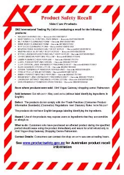
DNZ International Trading Pty
by bitsy
P r o du c t S a f e t y R ec a l l Skin Care Prod...
Team May1310 Team Members:
by pressio
Taylor . Bouvin. – CPRE. Kok. . Aun. . Chee. ...
Mobile Worklists Pam Skittino
by danika-pritchard
Deerfield Public Library. November 20, 2015. Step...
Integrated barcode chips for rapid, multiplexed analysis of proteins in microliter quantities of bl
by tatyana-admore
Jenny Zhou and Anne Ye. 12-9-11. Fan, . Vermesh. ...
QR / 2D Barcodes: Overrated, Misused or a Little of Both?
by lindy-dunigan
Originally developed in Japan in 1994 . to help t...
Building the Intelligent Mail
by yoshiko-marsland
®. Barcode: . Initial Steps for Mailers. From P...
Building the Intelligent Mail
by debby-jeon
®. Barcode: . Initial Steps for Mailers. From P...
References 2-1 2-2 Barcoding Limnetic Zone Invertebrates from
by karlyn-bohler
Green’s . Creek, . Brookside . County Park, Wes...
ICT in Shopping
by alexa-scheidler
ICT in business. Barcode Scanning. What is barcod...
To call into the webinar…
by natalia-silvester
Dial (571) 317-3112. Access Code: 822-292-181. Au...
Document Imaging
by pamella-moone
Barcode Scanning. 2. Goals. To demonstrate how us...
To install the TDA package on a PC:
by giovanna-bartolotta
. . . install.packages. ("TDA. ")....
Put Dispensing Errors
by yoshiko-marsland
Behind Bars. Implementation . of Barcode . Scanni...
mand Barcodes
by lois-ondreau
CHS 1D Imager Command Barcodes CHS 1D Imager Comma...
CBOL, DNA
by liane-varnes
Barcoding. and Long-Term Ecological Studies. Dav...
*Postdoctoral Fellow,, California Institute of Technology
by yoshiko-marsland
#. Assistant Professor, SUNY Albany. Jun Wang. *#...
Visualizing
by tatiana-dople
Multi-dimensional . Persistent Homology. Matthew ...
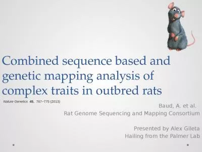
Combined sequence based and genetic mapping analysis of complex traits in outbred rats
by maisie
Baud, A. et al. . Rat Genome Sequencing and Mappi...
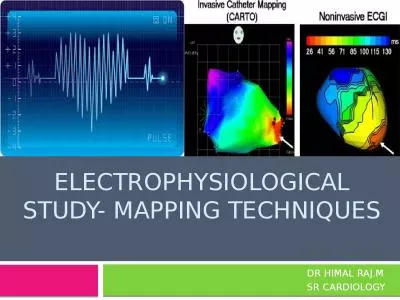
Electrophysiological study- mapping TECHNIQUES
by sophie
DR HIMAL RAJ.M. SR CARDIOLOGY. Contents . History....
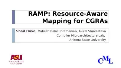
RAMP: Resource-Aware Mapping for CGRAs
by dandy
Shail Dave. ,. Mahesh Balasubramanian, Aviral Shr...
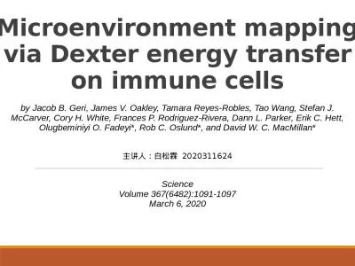
Microenvironment mapping via Dexter energy transfer on immune cells
by adah
by Jacob B. Geri, James V. Oakley, Tamara Reyes-Ro...
Data Analysis Group NGS Read Mapping
by carny
16. th. August 2019. Alignment basics. NGS alignm...
Curriculum Mapping: Flipped
by cappi
, . Automated. , and . Easy. Gerald Thrush, PhD &a...
Dr. James Abbott Read Mapping
by reese
j.abbott@dundee.ac.uk. From your home directory, r...
Mapping SIG Conference Call
by brooke
April 13, 2015. 19:00 UTC. https://. global.gotome...
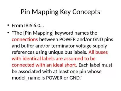
Pin Mapping Key Concepts
by tabitha
From IBIS 6.0…. “The [Pin Mapping] keyword nam...
Load More...