PPT-Features of Maps Title The title tells the subject of the map and gives an idea of what
Author : kittie-lecroy | Published Date : 2018-03-13
Compass Rose The compass rose shows the directions north south east and west Legend The legend or key lists and explains the symbols and colors used on the map Scale
Presentation Embed Code
Download Presentation
Download Presentation The PPT/PDF document "Features of Maps Title The title tells t..." is the property of its rightful owner. Permission is granted to download and print the materials on this website for personal, non-commercial use only, and to display it on your personal computer provided you do not modify the materials and that you retain all copyright notices contained in the materials. By downloading content from our website, you accept the terms of this agreement.
Features of Maps Title The title tells the subject of the map and gives an idea of what: Transcript
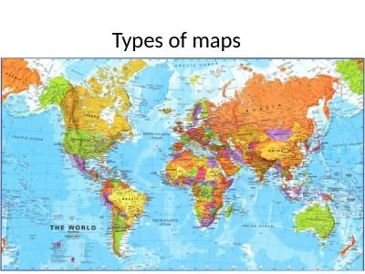
Compass Rose The compass rose shows the directions north south east and west Legend The legend or key lists and explains the symbols and colors used on the map Scale A scale can be used to figure out the distance between two locations on a map. Historical Maps. The oldest map?. Konya . town map, Turkey, c. 6200 BC. Milestones Project. http://www.math.yorku.ca/SCS/Gallery/milestone/. The First World Map. Anaximander of Miletus, Turkey, c. 550 BC. Peter A. . Weenink. This presentation…... The old map. The new map. The . InterActive. Maps ( IAM) . on the Internet (online, . wifi. ). I. n October 2014, I visited the . InterGeo. . event in Berlin. While walking through the . for . Windows Store Apps. Chris Pendleton. Sr. Program Manager, Lead. 3-133. Bing Maps on Windows 8. Bing Maps for JavaScript. Bing Maps for Managed & Native Code. Application Protocol Handling. Licensing. A tool for your toolbox. Visual strategy to support students. Consequence maps. Contingency maps. Behavior maps. What are consequence maps?. Helps students to . visualize consequences . of actions. Gives you and the student . Why are maps, knowing how to read them, and to draw them (cartography) so important?”. I. What can maps show us?. Your Thoughts (in your notebooks under Roman Numeral I:. Symbols and Abbreviations for Outlining . pz.tt/CSUN16-map. Dyslexia. Moderate vision impairment. Severe vision impairment. Epilepsy. Migraines. Physical impairment. Fibromyalgia. Multiple Sclerosis. Crohns. Disease. PTSD. Aspergers. It’s not just . Map Reading. Map Reading. Learning Outcome 1:. Know about the scales and features of Ordnance Survey maps. Map. Noun. Flat representation of the earth or some part of it with its physical or political features or of the heavens. distort a certain property. .. Definition: The representation of the globe on a two dimensional flat map.. All maps have four features that can be distorted that include: Shape, Size (area), distance, and direction. The reason for this being that there is no perfect way to represent a 3-D object on a 2-D plane. Each different type of map sacrifices one or more of these properties to make a flat map. . . Presenter: Alicia McGee. Email: . amcgee@mobilemcps.org. Make a copy of this to take notes!. Maps and Geography . We want students to become global students….. So….. Students should be able to:. DITA Map Definition and Purpose. Power of DITA Maps. DITA Map Types. Bookmaps – Additional Information. DITA Maps Practice. DITA Maps Examples. Under the DITA Map Hood. DITA Maps Best Practices. DITA Sub-map Uses. 1 The graphic representation of the geographical setting is called a map. A map is a symbolic depiction emphasizing relationships between elements of some space, such as objects , regions , or them DR. KAUSTUV MUKHERJEE. Assistant Professor. Dept. of Geography, C.M.. Maps. What are the different kinds of maps?. Political Maps. Political maps . show how humans have impacted the landscape. For example, city names, roads, country borders, etc. are all part of political maps. . How to read a map. Maps . are pictures of the Earth's . surface. Reference maps . just . show natural features like rivers, cities, political subdivisions and highways. .. Thematic maps . use these items only . The oldest map?. Konya . town map, Turkey, c. 6200 BC. Milestones Project. http://www.math.yorku.ca/SCS/Gallery/milestone/. The First World Map. Anaximander of Miletus, Turkey, c. 550 BC. Milestones Project.
Download Document
Here is the link to download the presentation.
"Features of Maps Title The title tells the subject of the map and gives an idea of what"The content belongs to its owner. You may download and print it for personal use, without modification, and keep all copyright notices. By downloading, you agree to these terms.
Related Documents