
Peter A Weenink This presentation The old map The new map The InterActive Maps IAM on the Internet online wifi I n October 2014 I visited the InterGeo event in Berlin While walking through the ID: 463002
Download Presentation The PPT/PDF document "The Power of Interactive Maps." is the property of its rightful owner. Permission is granted to download and print the materials on this web site for personal, non-commercial use only, and to display it on your personal computer provided you do not modify the materials and that you retain all copyright notices contained in the materials. By downloading content from our website, you accept the terms of this agreement.


Slide1
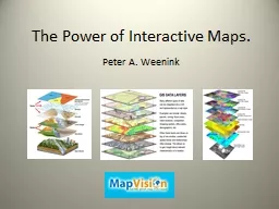
The Power of Interactive Maps.
Peter A. WeeninkSlide2
This presentation…..
The old mapThe new mapThe InterActive
Maps ( IAM) on the Internet (online, wifi)In October 2014, I visited the InterGeo
event in Berlin. While walking through the exhibitionhalls, I suddenly had a frightening split second about all the available software, uav’s, measuring-instruments, camera’s and GIS-systems, and I directly asked myself; Where is my privacy, who is using my own not released “free” generated data and where will this end ?
Slide3
Peter Weenink
My BIG passion for maps;I travelled around the world from my childhood till now,My love for maps and their backgrounds made me a Cartographer and a data-miner,
Informative character of map and atlases,Collection of physical maps/atlases and an enormous digital DATA-base,Hoping for the biggest world atlas, Earth Platinum (EP), into de “Low Countries”.
Teaching the knowledge of the map to individuals & groups through MapvisionSlide4
Maps, from History till
Today.Topographical =
==> thematical (subjects) nowadays using DATA visualization.
Static ----> paper (platform), drawn/printed formatDynamic ----> <-
--- screen (platform), software format; zooming (less detailing)InterActive (IA) <-
-->
<-
--> screen (platform), software format; zooming,
Q & A
,
Definitions are “widely usable
”;
gradations and ranges are within a "sliding scale”.Static Map, Dynamic Map, InterActive Map ===> StatM, DM, IAM (Semi IAM).Old (topo)situation on an old (ancient, antiquarian) clay or paper map,The then current situation on an old (antiquarian) paper map,Old situation on a nowadays paper/digital/app map, The current situation on a nowadays paper/cloth map, The current situation
digital maps using infographics, texts/storytelling, stats, (sat)pics,Real-time situation on a nowadays digital/app map, (incl. time-delays),2D Map digital maps using navigation & distances,3D Map digital depth-maps (on earth surface),4D Map using time (sliders), sounds/noise, movement or else.Slide5
InterActive Maps need…..
DATA, lots and lots of Data, BIG Data!Free data: static + mobile + realtimeYour data: privateBought data:
government/institutions/organizationsLocal, regional, international dataBy all means !!!Slide6
The Map.
Many of us do have a “Hate – Love
” relationship to the map; Difficult visualizations bring incomprehensible information.Sender (Cartographer/GIS-technician) <==> Receiver (user)
http://
www.theguardian.com/world/datablog/interactive/2010/oct/23/wikileaks-iraq-deaths-map Slide7
Satellite Map (
esri
)
Fra Mauro Worldmap from 1435(static)
http://
maps.esri.com/rc/sat/index.html
Slide8
Our World, mapping the static map and keeping the map simply colorful,
or making sophisticated InterActive Maps.Slide9
The Internetmap
(Connections/Communication).Dynamic: only zooming.
http
://internet-map.net http://the-internet-map.blogspot.nl/2012/09/map-layout-process-video.html Slide10
Early interactive map ?
Distoguide ® from Hallwag
(CH) E-Distoguide® by QR-Code.
From Geneva to
Poschiavo
is 553 km.Slide11
Who Provides the modern InterActive
Map (IAM) ?Google, esri or else? Individuals & Tech start-ups !Slide12
What brings the InterActive
Map?Safe Society, Your Safety; Quality of Life!At home, on the street, your
geographic area influences you day by day, so knowledge is “ lifesaving ”!
Education, shopping, food,Crime, vandalism, services Personal health, childcare, demography,Flooding, drought, weather,Environment, pollution,Leisure, free time, sports, transport,communication, politics,
Your PC use and data storage.Slide13
Do we need highly technical, detailed or
simple ?Slide14
Shop till you drop!
The NY shopping map. The website has gone (ERROR 404), but the App is there!Search by www.archive.org Slide15
Techniques &
calculations behind the IAM map. http://www.jasondavies.com/maps/voronoi/airports/
http://bl.ocks.org/mbostock/raw/3711652/
http://www.mapvision.eu/node/map-projections/
Voronoi ProjectionsSlide16
Baby
names; this interactive map shows the top 100 of names per US state per year. The Java technology might be obsolete, a new version seems to be on its way
.Slide17
If we work internationally, we should speak many languages!
Where do they speak Popoloca
or popoluca ?http://www.verbix.com/maps/where-do-they-speak/ (6545 languages
, Dynamic)Slide18
Flooding or drought?
http://
www.floodmap.net
http://
globalfloodmap.org Slide19
Weather mapping.
https://www.windyty.com/?surface,rh,now,52.367,4.900,4
Ireland February 2014
http://www.meteoearth.com/#/,
19.74,59.10,2.12,6,1,1,0,1,0,time=1431940860
Slide20
Je Suis Charlie,
twittermap. http://srogers.cartodb.com/viz/123be814-96bb-11e4-aec1-0e9d821ea90d/embed_map Slide21
Bundestagswahl 2013 in Berlin.
All votes from all 1709 polling stations
. http://berlinwahlkarte2013.morgenpost.de/#partei=13 Slide22
TransportDifferent (
realtime) IAM models for a big global audience !
http://
planefinder.net
www.marinetraffic.com
Semi IAM New York TransportSlide23
Kaspersky & DDoS
attack map. https://cybermap.kaspersky.com/
http://www.digitalattackmap.com/#anim=1&color=0&country=PH&list=0&time=16235&view=map Slide24
Music maps.
(Audio & time)
http://andywoodruff.com/blog/the-music-of-geography-ohio-is-a-piano/ http://
austinmusicmap.com Ohio Pianomap
, Austin MusicmapSlide25
And, New York by night…..
http://uk.businessinsider.com/aerial-photographs-of-new-york-city-2015-1?r=US
Slide26
At the end……
Interactive Maps (IAM) are:Informative, providing more and more global subjects,
Useful to create to get a better, safer & healthier society,Necessary in a fast growing (digital &
physical) world,Educational for scolars, students and professionals,Easy accessible (mostly) and
attractive for the eye.Sometimes a “once in a lifetime map”.ButAllways check your information for Source, Provider and the “Truth” before official use,Allways
use a second “opinion”, the more sources/data, the better !Slide27
Thanks for listening!
http://ukdataexplorer.com/european-translator/?
word=to+translate